No collection found
Are you sure?
This will unsave the project your collection.
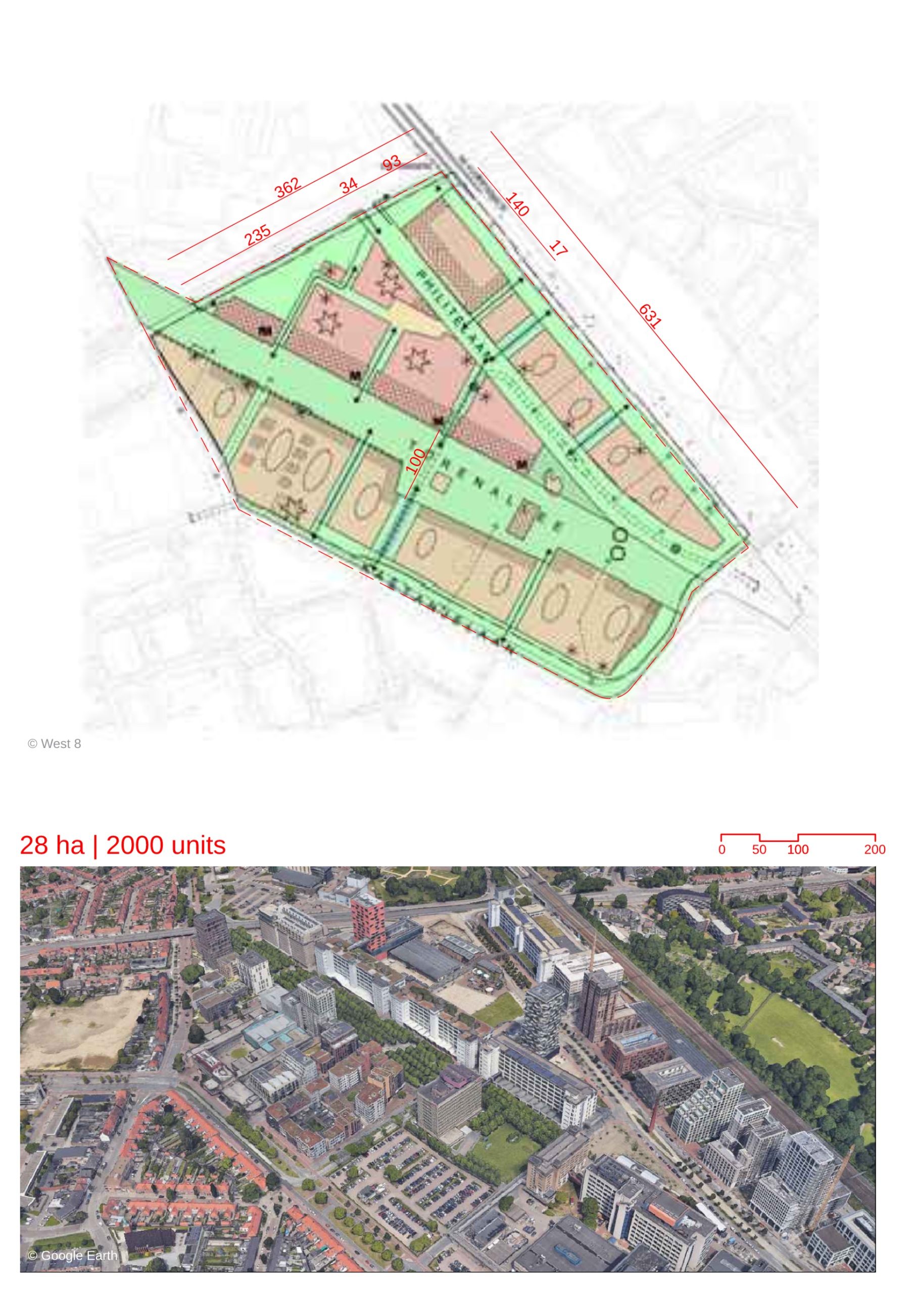
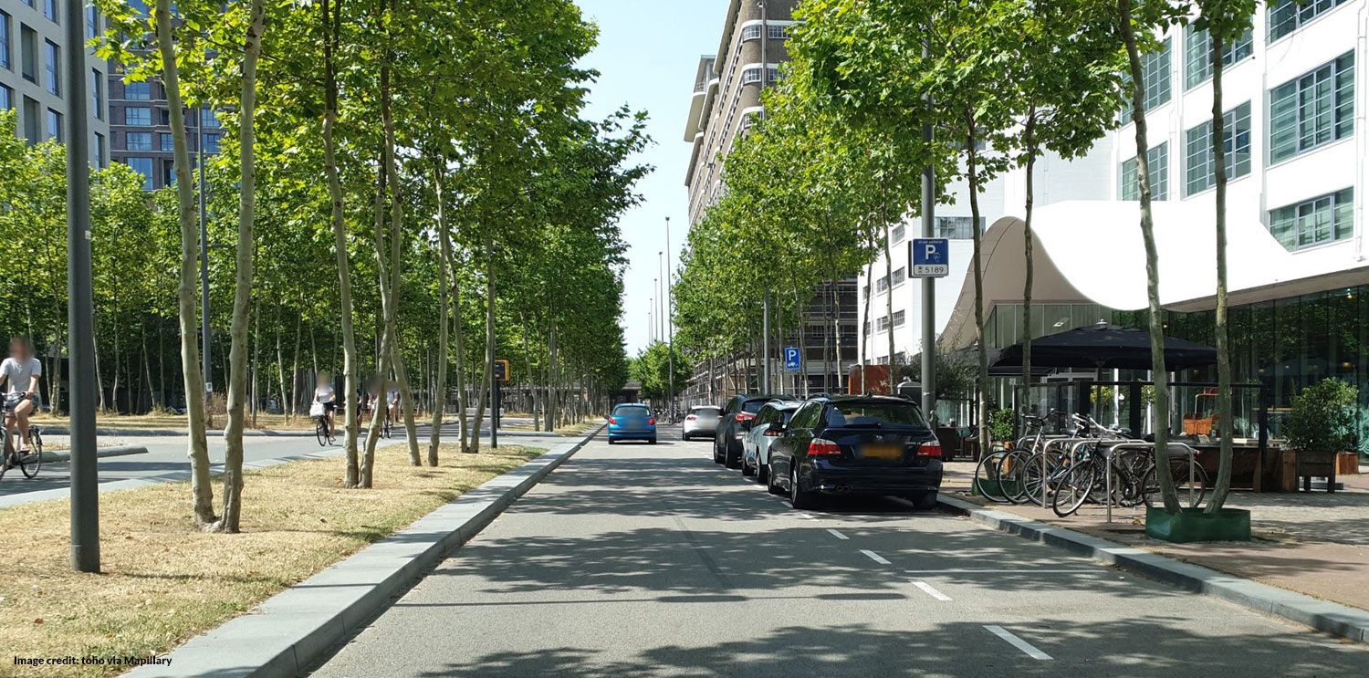
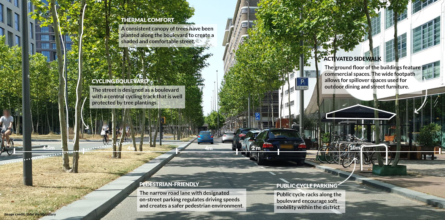
-It is a post-industrial urban district located in the former industrial campus owned by Phillips. -The area is being developed as creative city with diverse programs, such as housing, offices, restaurants and markets, accommodated in the industrial buildings. This region would promote culture as well as technological innovation. -It was decided that the industrial activities would be relocated, when the site was handed over to the city in 2001. Urban Structure -The wedge-shaped site is located close to the city center of Eindhoven. The blocks have an orthogonal character which has been retained in the newer development as well. -The Torenallee is a 60-meter-wide central urban axis running through the entire length of the site as a defining element. Two monumental buildings are located as landmarks on this axis. -Two urban boulevards run parallel to the main axis. They act as secondary streets for the newly planned residences and workspaces. -There is a clear segregation of public and private spaces within the urban blocks. The creation of courtyards and garden provides residents with private communal spaces. -The buildings exhibit architectural variation through different heights , rooflines and forms. -The architecture of newer development follows a system of “accents, matrix and special” characters. The accents are elements like finish and details. The specials consist of buildings that are designed to act as landmarks with special features. This ensures that spatial quality is maintained. -High rise buildings are designed to accentuate their height through narrower floor plates and twisted forms. Mobility -The entire district primarily consists of 30km/hr road zones. -The newer parking is designed in structures, underground or as semi-sunken lots. This would prevent parking areas from dominating streetscapes. -Cycling paths and wide cycle lanes encourage cycling. -Th district is being planned as a live-work environment where residents are at an average distance of 200m from the workspaces. Creation of Public Space - The Torenallee forms the central public space. It is planted with trees and features elements like kiosks and furniture. Two sculptural buildings act as landmarks on it. -The urban boulevards are designed as wide streets with a thick canopy of trees. There is also a square lined with restaurants along one of the boulevards. -A green corridor also runs at the centre of the district planted with trees. -Several industrial buildings have been revamped as recreational areas. Old lots are being used for open-air markets. -Various facilities have been developed in the industrial buildings for urban sports like skateboarding. Industrial Heritage -The district is known for incorporating modern programmes in the existing industrial buildings. -Leidingstraat or “Pipe Street” is a walkway which has industrial buildings with a network of industrial piping on their exterior. These pipes were used to transport gas, water and other elements between the buildings. This stretch has been redesigned with a concrete streetscape. Planters, staircases and viewpoints have been created in between the pipes. -The Anton and Gerard buildings were former factory buildings. They are now repurposed as loft living apartment blocks. Similarly other buildings are being used as restaurants and commercial spaces. Sustainability -The area is sourcing energy through a biomass power station and solar panels. -A majority of the streets are oriented east-west to maximise south facing facades. Living Labs -The district is using smart technology to monitor and operate its urban functions. For example; Mobility-S is a parking system which provides real time information on parking facilities, as well as collects data on supply and demand over a period of time. -Plug-In City is an area within the district that acts as a open air makerspace and gallery. Creatives can create and display their proposal ranging from galleries to pavilions. It acts as a testbed for innovation.