No collection found
Are you sure?
This will unsave the project your collection.
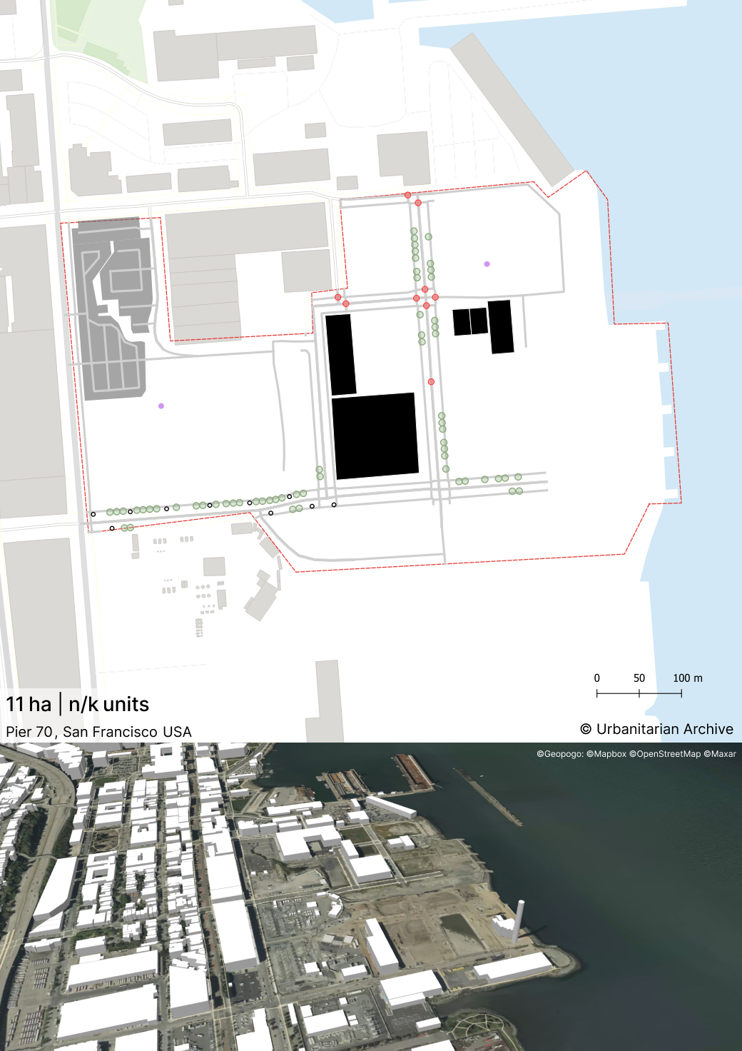
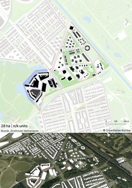
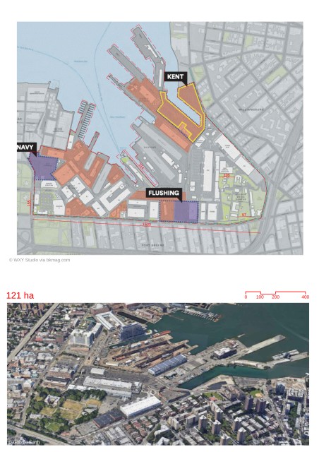
-It is a port site along the coast of San Francisco. It was used as a shipyard for ship building activities in the olden days. -It is being developed as a mixed-use neighborhood with craft and light industries. The new development pays homage to its industrial past through the architectural and design features. - The old layout of narrow alleys and interstitial spaces between industrial buildings are being redesigned as public spaces -A creative core has been created for craft, light manufacturing, retail and the art industry. -The waterfront is publicly accessible with parks and promenades. Land Use -The are would encourage a mix of uses to create a vibrant neighborhood. New housing would be introduced, including affordable dwelling units. Other elements in the program include creative production spaces, retail frontages, offices, parking and public spaces. -A creative core has been created centrally. It extends from the center towards the waterfront.It would be designed as a pedestrian-scaled zone. Retail frontages along the core would help enliven the public realm. --Ground floor would have active public uses. Retail and service uses along retail corridor. Urban Structure -The existing historic buildings and industrial slipways(alleys) are used as the basis of massing and open space design, with the alleys incorporated as landscape features. -Location specific guidelines have been used to define building forms and design. For example; new buildings would be designed to complement existing buildings in a contemporary style in the historic district, waterfront buildings would have public amenities and long facades would be treated with varying materials and detailing to improve pedestrian experience. -The maximum building height would be 90 feet. -The urban blocks are linear. Originally used for industries, they provide areas for large building footprints. -Main streets connect the surrounding areas to the waterfront. A retail corridor runs parallel and in close proximity to the waterfront. Mobility -The district has streets equipped for both pedestrian and vehicular access throughout majority of the site. -Areas for loading and truck movement ensure that they are away from the public spaces and waterfront. -The retail corridor is designed as a raised street. This is used as a traffic calming measure and provides a priority to soft mobility. On-street parking along this corridor helps attract visitirs and acts as a buffer between pedestrians and vehicles. -Mid-block passages have been provided between buildings and public areas. Access to Nature -A waterfront terrace and promenade are being developed along the water’s edge. This would improve public access to the water and create a lively waterfront public space. -The remnant mound of Irish Hill, a historic worker’s housing site, is being developed as the green heart of the district. It would provide planted areas and areas for sports. Creation of Public Spaces -Open spaces would be layered with multiple purposes. They would be flexible to incorporate different uses over time. Minimum width of open space would be 10’ in width. -The public spaces would prioritize views towards the water or Irish Hill depending on their location. - The Waterfront Terrace is designed with event spaces and softscape area for leisure, lawn games, fitness. It provides views towards ship repair activities nearby. -The Slipway commons features a hardscape for events and a flexible open plaza. It connects the retail corridor with the waterfront. -Public plazas and squares are located amidst industrial buildings and along the streets -Ground floors would have a differentiated base. These would mean a difference in materiality, texture or form(setbacks). The base is ideally 1-3 stories in height. This helps maintain human scale along the streets. -Newly Constructed dwelling Units would be exposed to courtyards public spaces or streets. All buildings would have prominent ground floor entries at specified distances which would lead to the residences/offices or other functions occurring in the building. - Long facades of building will follow strategies of massing (setbacks,courtyards) , modulation(façade articulation,multiple façade systems), materiality in order to create architectural variation and improved identity and pedestrian experience.