No collection found
Are you sure?
This will unsave the project your collection.

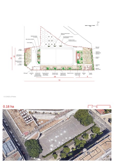
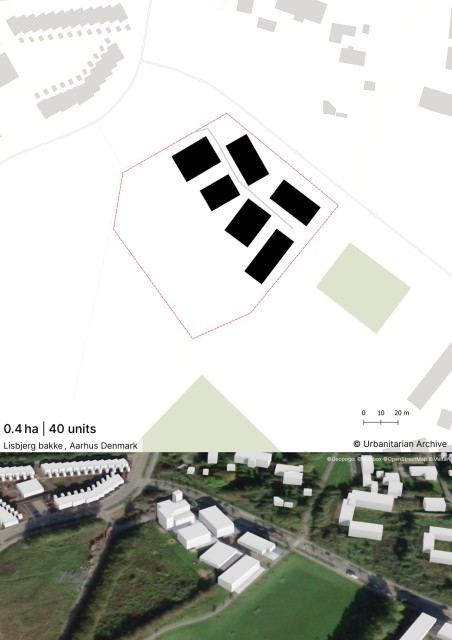
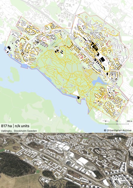
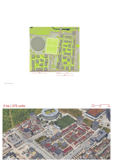
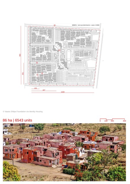
-The area of Amaravati was selected to be the capital city for the newly bifurcated Indian State of Andhra Pradesh in 2015. The selection considered the area’s strategic location, abundance of natural resources and its historical importance. -The Amaravati Capital City is being proposed as a greenfield master plan development, where the area is being procured through a “land pooling scheme”. Land pooling involves the local farmers and landowners providing their farmland towards the development of the city in exchange for a developed plot. -The masterplan follows a grid pattern and is being developed with axes and primary roads along the cardinal north-south direction. -The city would have three prominent axes. A north-east axis along which exist key cultural landmarks, is being further developed as a recreational corridor. In addition would be a civic axis along north-south and a waterfront axis. -The center of the city is being planned as a area of green open spaces, reinforcing the idea of a “Bhramasthan” ( meaning silent center) for the city. -The city is being developed as clusters of townships. The townships are part of the modular planning strategy for the city. -Each township would consist of several communities. Each community would be of 500x500 m having up to 4550 housing units and would act as the basic cell of the city’s masterplan. These areas would have greenery, be pedestrian friendly and have access to daily amenities. -The concept of the “Bhramasthan” (silent center) discussed at the macro scale would be implemented at the micro scale where there would be an central open space for each cluster. -The townships would house walkable neighborhoods through a network of “local streets”. They would be connected to economic nodes through public transport. -An important aspect of the township planning model is the integration of existing settlements in the area and connecting them to newly developed facilities such as commercial centers.
-
https://crda.ap.gov.in/apcrdav2/views/AboutAmaravathi.aspx
-
https://gis.apcrda.org/lps/index.html
-
https://crda.ap.gov.in/apcrdaCOMMUNI/media/apcrdadocs/WorkshopPanelPresentations/Global%20Health%20_%20Wellness%20Destination/Power/Amaravati%20Introduction%20V1.pdf
-
https://crda.ap.gov.in/APCRDADOCS/DataModuleFIles/Land%20distribution%20chart/01~1113Capital%20city.png