No collection found
Are you sure?
This will unsave the project your collection.
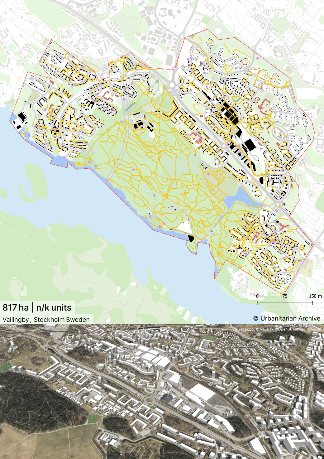
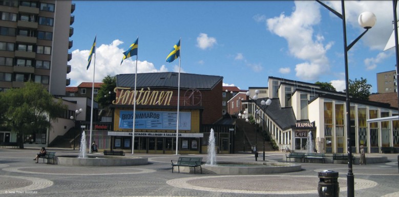
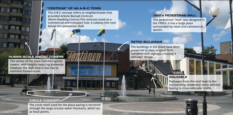
-It is a satellite town located along the subway line from Stockholm. -It was constructed as a post-war New Town.These new Towns were constructed as decentralized self-sufficient neighborhoods that would decongest the capital city of Stockholm while providing an ideal live-work environment for their residents. -Vallingby was one of the first A-B-C towns built in Sweden. The A-B-C concept refers to neighborhoods that provided Arbete-Bostad-Centrum(Work-Dwelling-Centre). These towns would be semi-sufficient neighborhoods with urban amenities and employment within walking distance. -Areas for work (A) were concentrated at the center to maintain accessibility. They constituted high rise blocks. -The center of the New Town (C) accommodates a variety of programmes such as retail,entertainment,commercial and recreational spaces. It was also a transportation hub with a subway station to commute to the capital, bus station and parking spaces. -The center was constructed as a concrete deck below which runs the subway line. A sprawling pedestrian mall has been created above the subway line.It connects the residences to the center without having to cross motor traffic. - A variety of dwelling (B) typologies were provided. High rise apartments(near the center) ,3 storey houses with courtyards (500 m from center) and single family homes (900m from center). On an average resident could access the town center/district center within 800m of their homes. -It was influenced by the neighborhood unit concept by Clarence Perry. -The layout of housing within the neighborhood units was more organic and did not strictly follow rectilinear layouts. Orientation of the buildings prioritized sunlight, views towards greenery and privacy over the efficiency of right angled schemes.This led to varying layouts of housing. -Vallingby follows the linear city model. The subway line forms the primary axis of the region’s development. -It consists of 5 districts that lie linearly along the subway line axis. -Each district is centered around the subway stop. District centers are located at the transport hubs.They offer amenities and facilities to the district's residents. -The neighborhood unit forms the smallest unit of the district. It consists of housing clusters centered around a park and common facilities like childcare.They were planned for 2000-4000 inhabitants. -A hierarchy of streets and roads ensures safety and maintains human scale in the housing clusters. -Various large accessible green spaces are located throughout the town to maintain strong connection with nature. -A network of cycling paths and pedestrian pathways connect the various districts. Traffic separation through underpasses and over bridges ensures that soft mobility is separated from motor traffic. -Overall the density of buildings was highest near the center and reduced as one moved outwards.
