Chandigarh
By
LE CORBUSIER
In
Chandigarh,
India
Save this project to one or more collections.
No collection found
Are you sure?
This will unsave the project your collection.
Compare
Compare this project with others
Details
Views:
1621
Tags
Data Info
Author
LE CORBUSIER
City
Chandigarh
Country
India
Year
1951
Program
New City
Technical Info
Site area
114000000 sqm
Gfa
0
sqm
Density
0 far
Population density
1325000
inh/ha
Home Units:
282267
Jobs
0
Streetsroad:
0
%
Buildup:
1
%
NonBuild-up:
0 %
Residential
0 %
Business
0
%
Commercial
0
%
Civic
0
%
Description
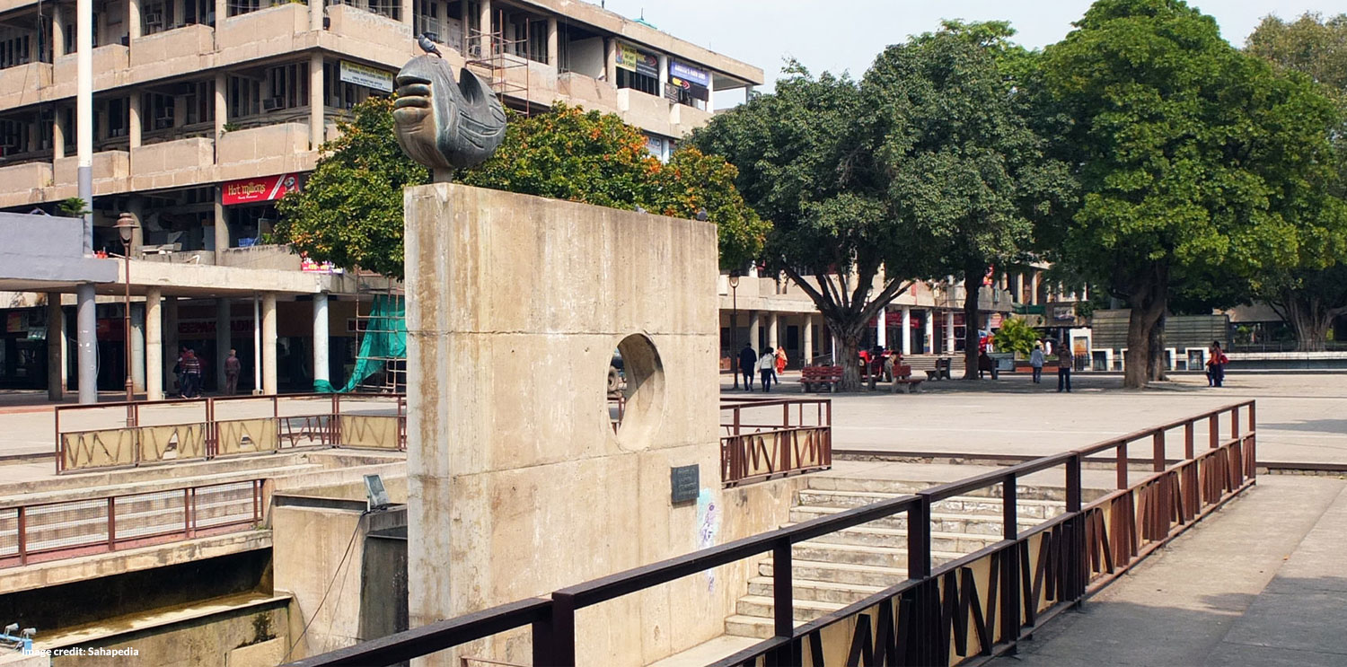
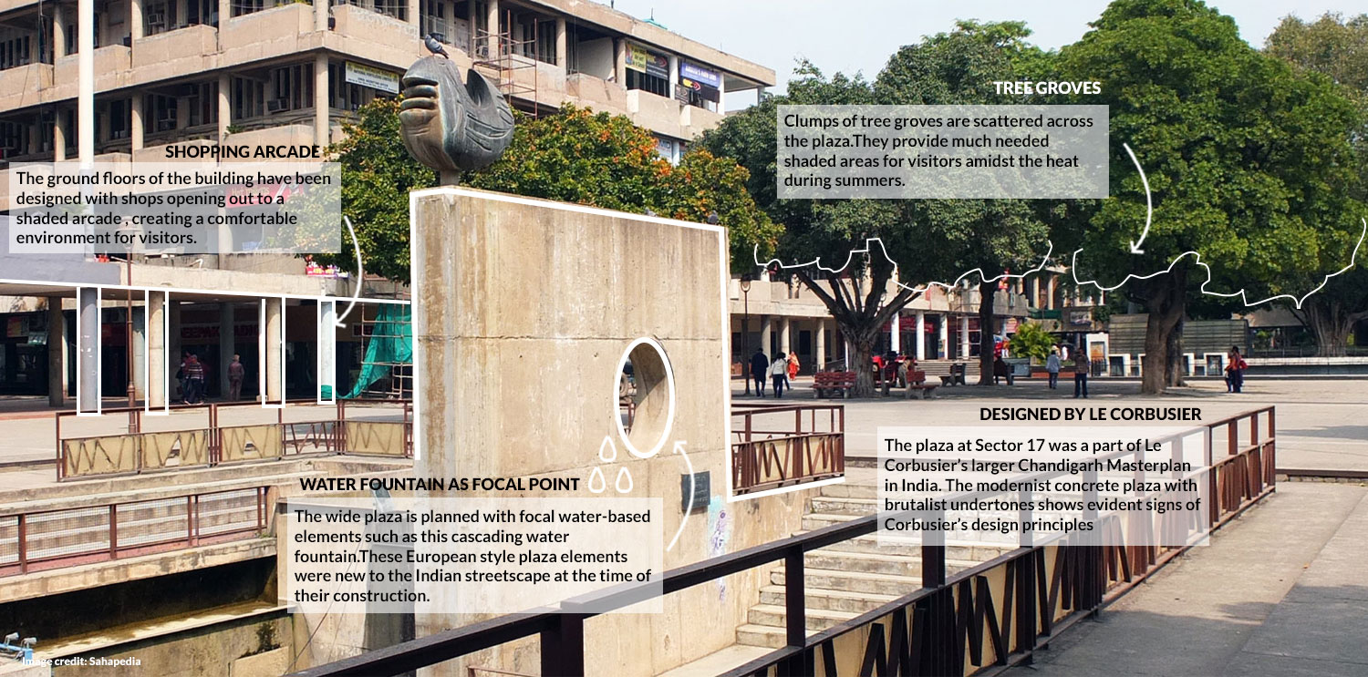
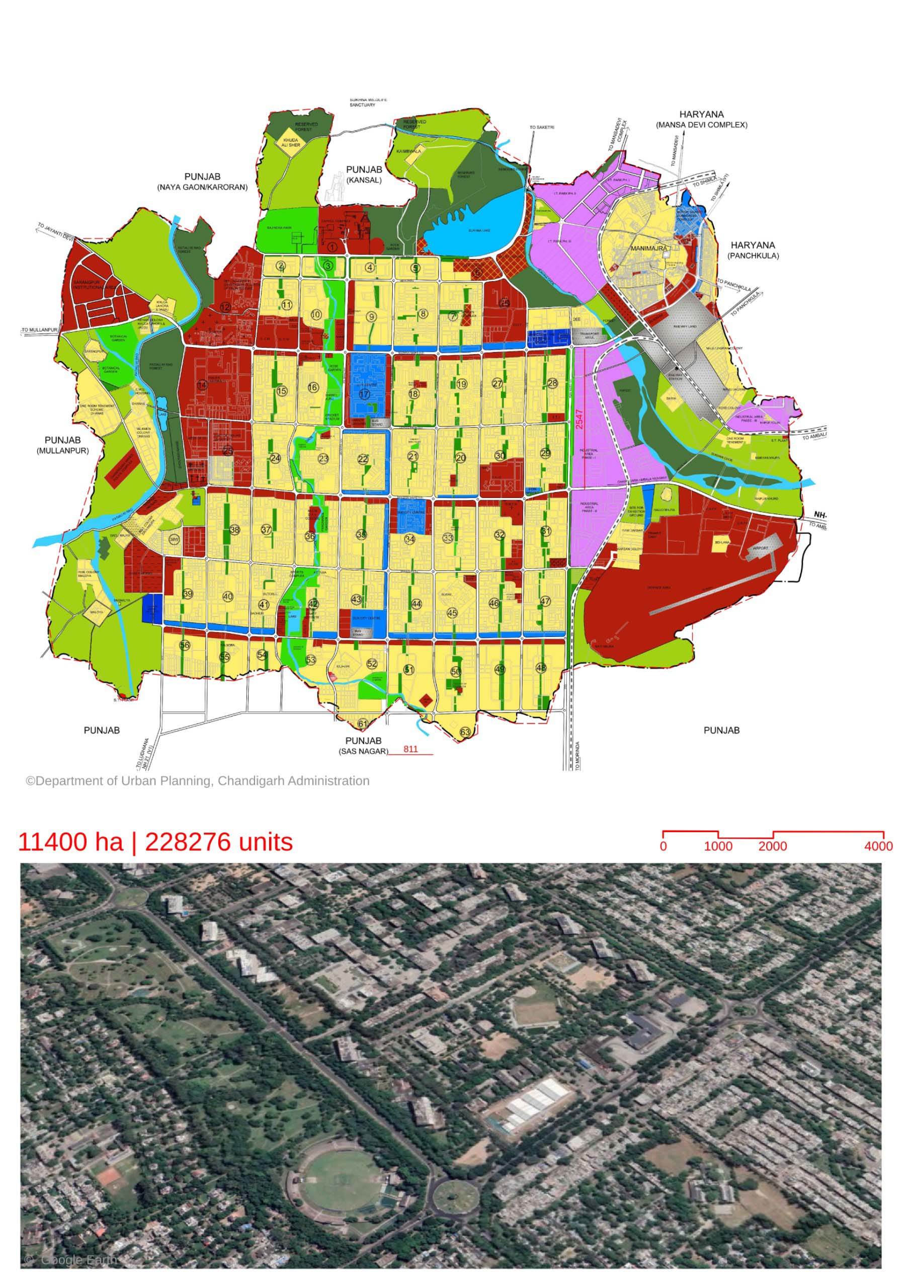
- Chandigarh is the capital city of two Indian States- Punjab and Haryana.Chandigarh was created as the administrative center for the bifurcated state of Punjab in newly independent India in 1948.The master plan of Chandigarh was designed by French architect Le Corbusier in 1951.
- The masterplan follows a grid-iron pattern, each unit of the grid was referred to as a sector. Each sector was to be 800x1200 m. At present, most of the sectors follow similar dimensions.
- The governing principles for the city functions were based on the CIAM theories(Congrès Internationaux d’ Architecture Moderne). The primary city functions were living, working, care of body & spirit, and circulation.
- The sector formed the basic module for the living areas. Each sector would be provided with basic amenities such as schools, places of worship and shops. The size of the sector was decided on the basis that all amenities would be within a 10 minute walk from a residence.
- The sector would have ample vehicular circulation around it, but limited vehicular circulation within. There was to be a sealing of sectors by walls , to maintain their introverted nature. The population of each sector varies from 3000-25000.
- Open spaces were designed as linear green belts running at the center of the sectors in the north-south direction. These were oriented towards the surrounding Shivalik hills and would be uninterrupted lines running from the hills. They were to be vehicle-free and were to have schools, parks and recreation areas.
- The circulation follows a 7 V system. There is a hierarchy of roads starting from V1 (highways incoming into Chandigarh) to V7( footpaths and cycle routes).
- While the roads V1-V3 were designed for efficient vehicular movement with their orthogonal pattern, the roads V4-V7 were designed with an increasingly meandering character to enhance the pedestrian experience.
- Chandigarh was planned to be a garden city. Every sector would have access to parks at a distance of 300m. The idea was that every dwelling would have access to Sun, Space, Verdure(greenery). A 500’ long green belt separates the residential and industrial areas.
- The city was planned to be a low-rise city, in line with Le Corbusier’s ideal for maintaining human scale. The distribution of population in the sectors was to be hierarchical , lowest at the North and increasing towards the South.
- A system of architectural controls has been set up to maintain the urban composition of the buildings and streetscape, which was a new concept in India. The controls range from urban forms to boundary walls of residences. They were meant to maintain a unified outlook and avoid demarcation based on class or socio-economic conditions of the residents.
Location map
Streetscapes
Explore the streetscapes related to this project.
|
Explore more Masterplans
