No collection found
Are you sure?
This will unsave the project your collection.
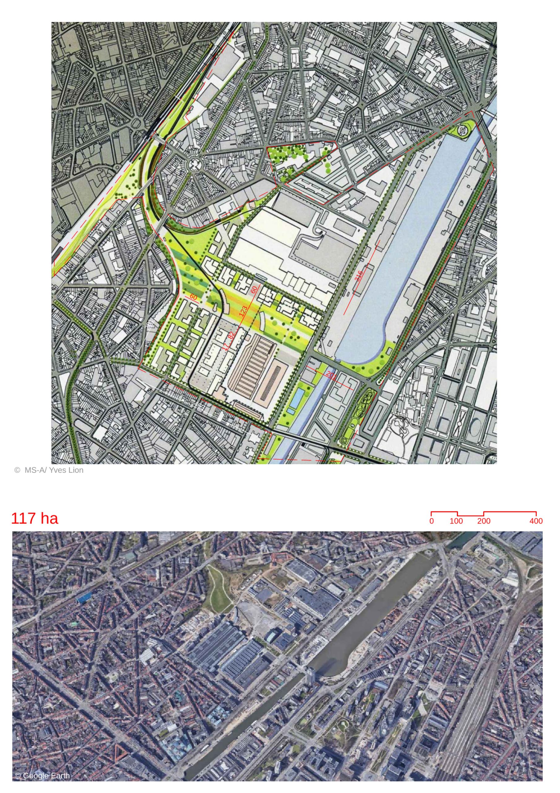
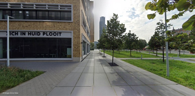
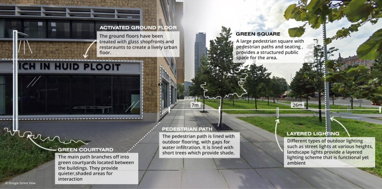
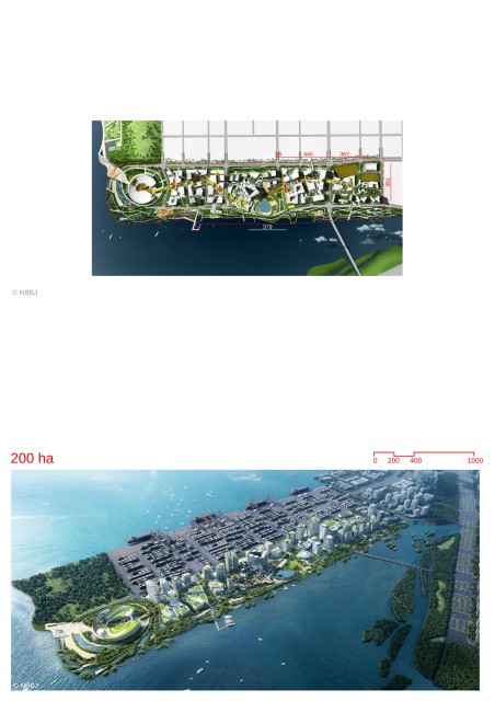
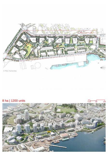
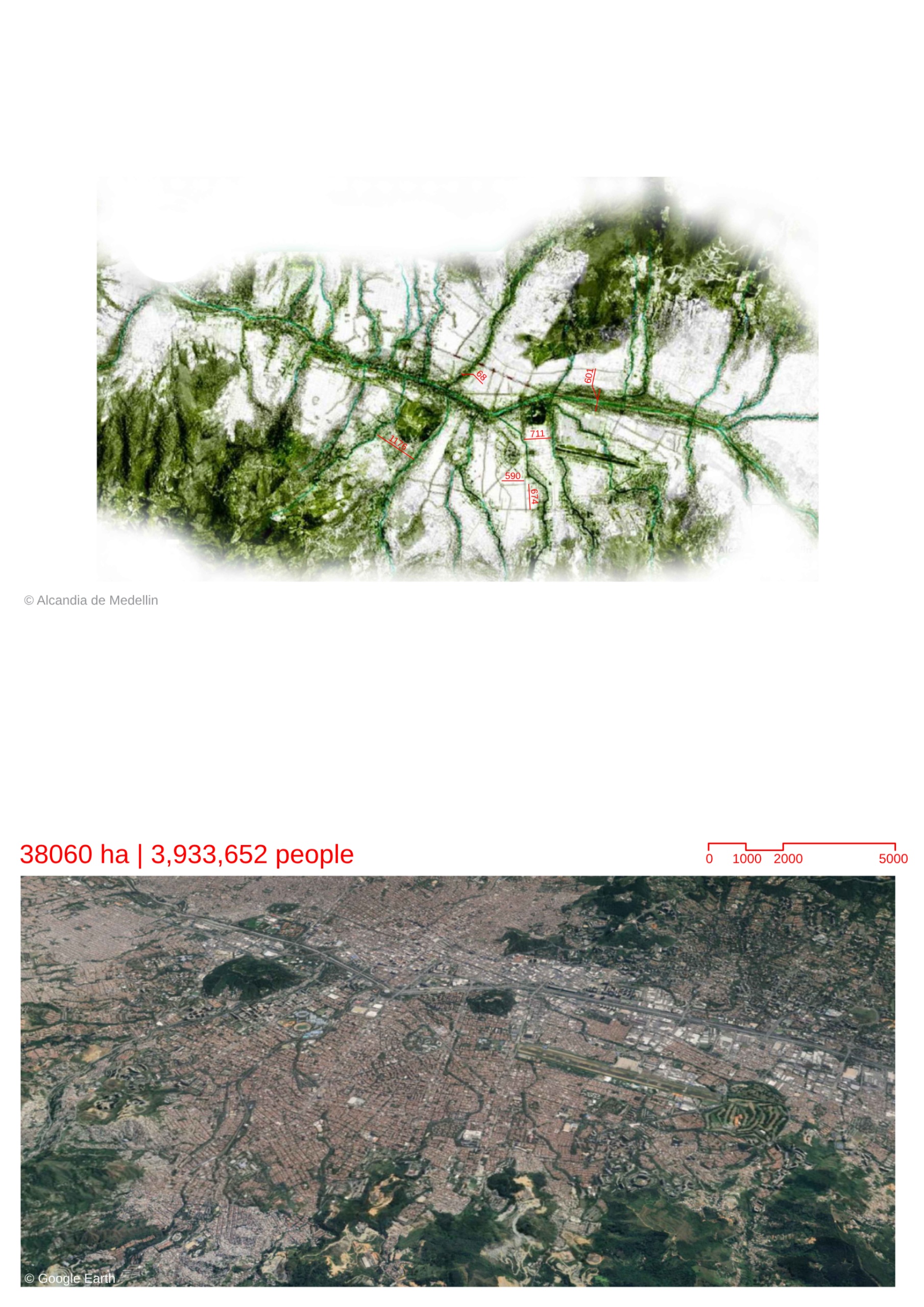
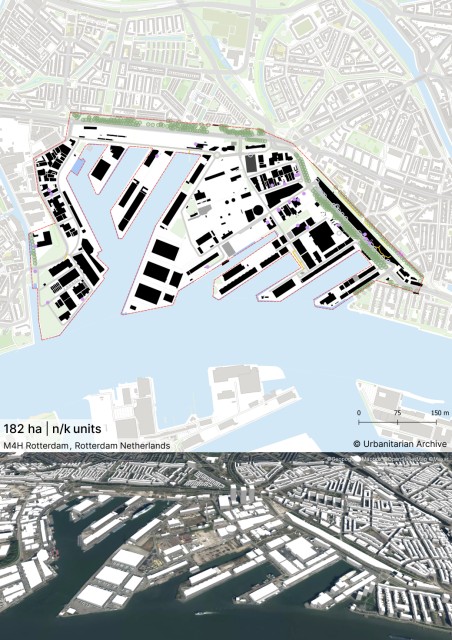
-It is an industrial site which included a port station and customs centre. -Gradually the industries shut down and the buildings were used as temporary event venues for events like the circus. -The masterplan was created to provide a framework for the regeneration of the abandoned spaces and to create a lively mixed-use neighbourhood which includes some logistics and port activity programs well. -The site would be developed based on sustainable urban development principles. Urban Structure -The urban blocks are large and have been retained similar to when they were used for industrial purposes. -A central park spanning 10 hectares is proposed at the centre. It extends outwards and acts a sa green link with the surrounding areas. -New Development is planned in the form of varied building forms along the green axis. -The scale of the existing monumental buildings would be a reference for new development. New development would have matching cornice heights with the historic buildings near the public open spaces. Land Use -The area would be made into a mixed-use district- 40 % for housing, 40% for office/production and 20% for facilities and businesses. -20 % of the residential programme would be social housing. -A portion of the site is reserved for economical port activities. There would also be a logistics centre to take advantage of the proximity to the freight station and waterway. Industrial Heritage -The existing Goods station building would be a central landmark. It is a large covered space. It would be densified with mixed-uses to take advantage of its central location. It would developed as a hub for public activity. -The large green park follows the route of the old railway line. The topography is preserved. -The railway embankments have been retained. The would be adapted for temporary uses such as vegetable gardens and hanging gardens. Creation of Public Spaces -The Goods station would be flanked by a large open-air public space of 120-meter width. It would host events as well as pedestrian movement within the site. -The existing abandoned industrial buildings at the centre would be preserved and repurposed for public activity. Mobility -A large portion of the district provides connections for pedestrians and cyclists. The district aims to reduce dependency on cars. -A tram line would also run through the district. -Connections to the surrounding would be improved through creation of bridges across the water as well as improved road and public transport. -Vehicular circulation is restricted to roads mostly along perimeter. Majority of parking would be underground. -A freight connection would be provided among the periphery of the logistics centre towards the waterway to enable efficient movement of goods and lessen goods movement through the roads. -The lorry traffic would be restricted to the economic and logistics zone at one portion of the site. Sustainability -Buildings would have large flat roofs to provide space for solar collectors. -Green roofs would be incorporated wherever possible. -Nature-based systems as well as traditional stormwater management systems would be used to manage rainwater.