GWL Terrein
By
KCAP ARCHITECTS
In
Amsterdam,
The Netherlands
No collection found
Are you sure?
This will unsave the project your collection.
Compare
Compare this project with others
Details
Views:
3845
Tags
Data Info
Author
KCAP ARCHITECTS
City
Amsterdam
Country
The Netherlands
Year
1998
Program
Residential development
Technical Info
Site area
57000 sqm
Gfa
0
sqm
Density
0 far
Population density
1380
inh/ha
Home Units:
600
Jobs
0
Streetsroad:
0
%
Buildup:
0
%
NonBuild-up:
0 %
Residential
0 %
Business
0
%
Commercial
0
%
Civic
0
%
Description
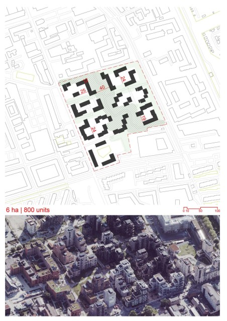
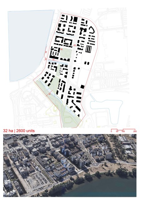
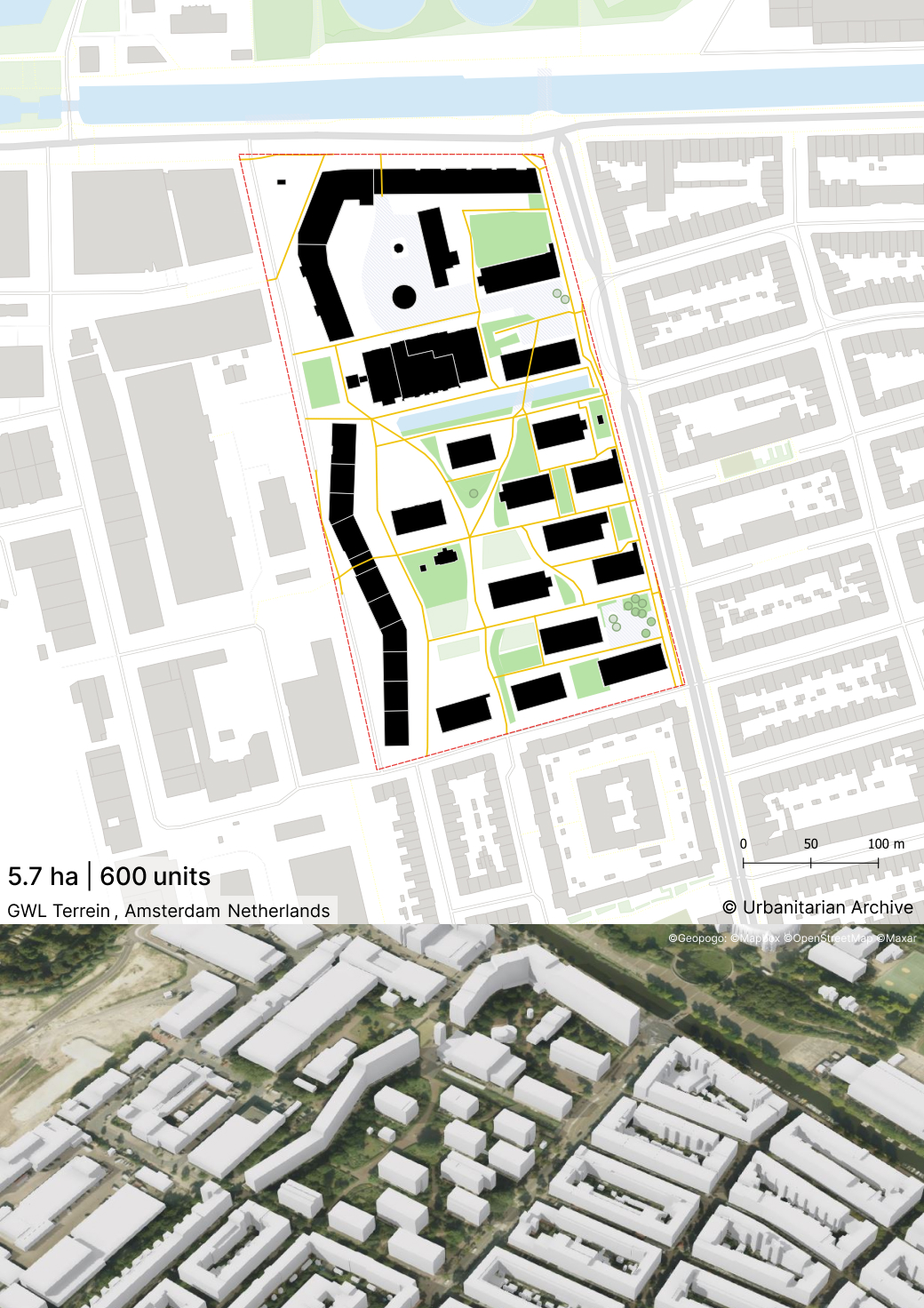
- The Westerpark municipal district council decided to develop the former municipal water board terrain (GWL terrain) in Amsterdam into a residential area in 1989.
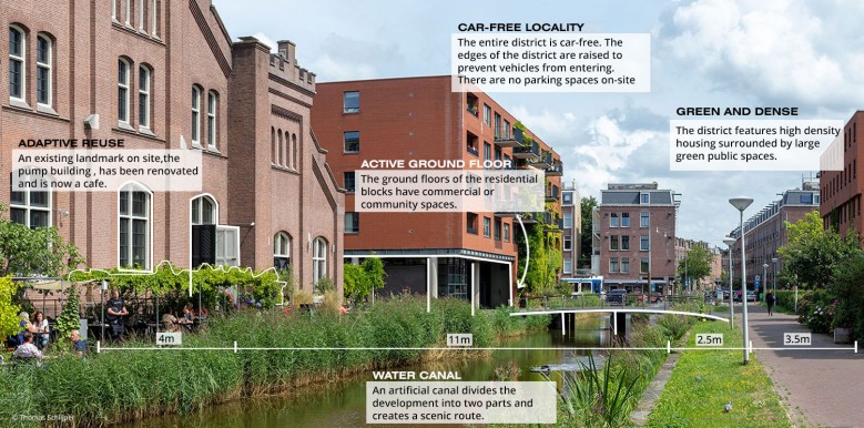
- The complex was to be a car-free, environmentally friendly residential area.
- The plans not only influenced car use but also car ownership - the only parking spaces available were created on the edge of the complex.
- The complex includes properties for both renting and buying, with the emphasis on larger houses for families.
- There are generous outdoor spaces, apartments with roof gardens, private gardens for the ground floor properties and a green public space intended not only for the residents, but also for those living in the densely built adjacent neighbourhoods.
- 6 ha, 1,400 inhabitants, 230 persons/ha, 600 residential units
- Distance from City Center: 3 km
- Cars: 190 cars/1,000 residents. Parking Spaces/Residence: 0.20. Non-motorized Mode Share: 80%. Public Transport Mode Share: 14%. Households with Carsharing: 26%
- Developer: Ecoplan Foundation
Location map
Interactive Map
This project includes an interactive map generated from GIS data, so you can study the masterplan as switchable layers instead of a single static image. Use the layer panel and legend to toggle buildings, green areas, water, streets, paths, site boundary, and trees to isolate specific systems and understand how they connect. You can also measure and change the basemap (light/dark/OpenStreetMap) to improve readability while you analyze.
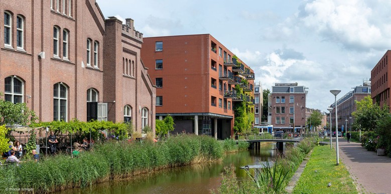
Streetscapes
Explore the streetscapes related to this project.
|
Resources
Explore more Masterplans