Milton Keynes
By
LLEWELYN-DAVIES, WEEKS, FORESTIER-WALKER, BOR
In
Buckinghamshire,
UK
No collection found
Are you sure?
This will unsave the project your collection.
Compare
Compare this project with others
Details
Views:
863
Tags
Data Info
Author
LLEWELYN-DAVIES, WEEKS, FORESTIER-WALKER, BOR
City
Buckinghamshire
Country
UK
Year
1970
Program
New Town
Technical Info
Site area
88700000 sqm
Gfa
0
sqm
Density
0 far
Population density
250000
inh/ha
Home Units:
82175
Jobs
0
Streetsroad:
0
%
Buildup:
0
%
NonBuild-up:
0 %
Residential
0 %
Business
0
%
Commercial
0
%
Civic
0
%
Description
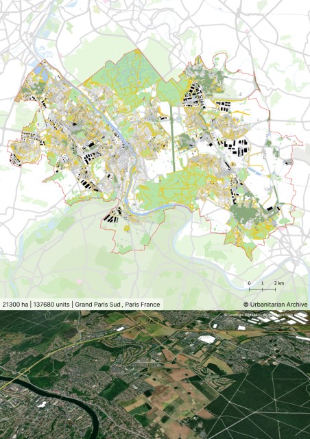
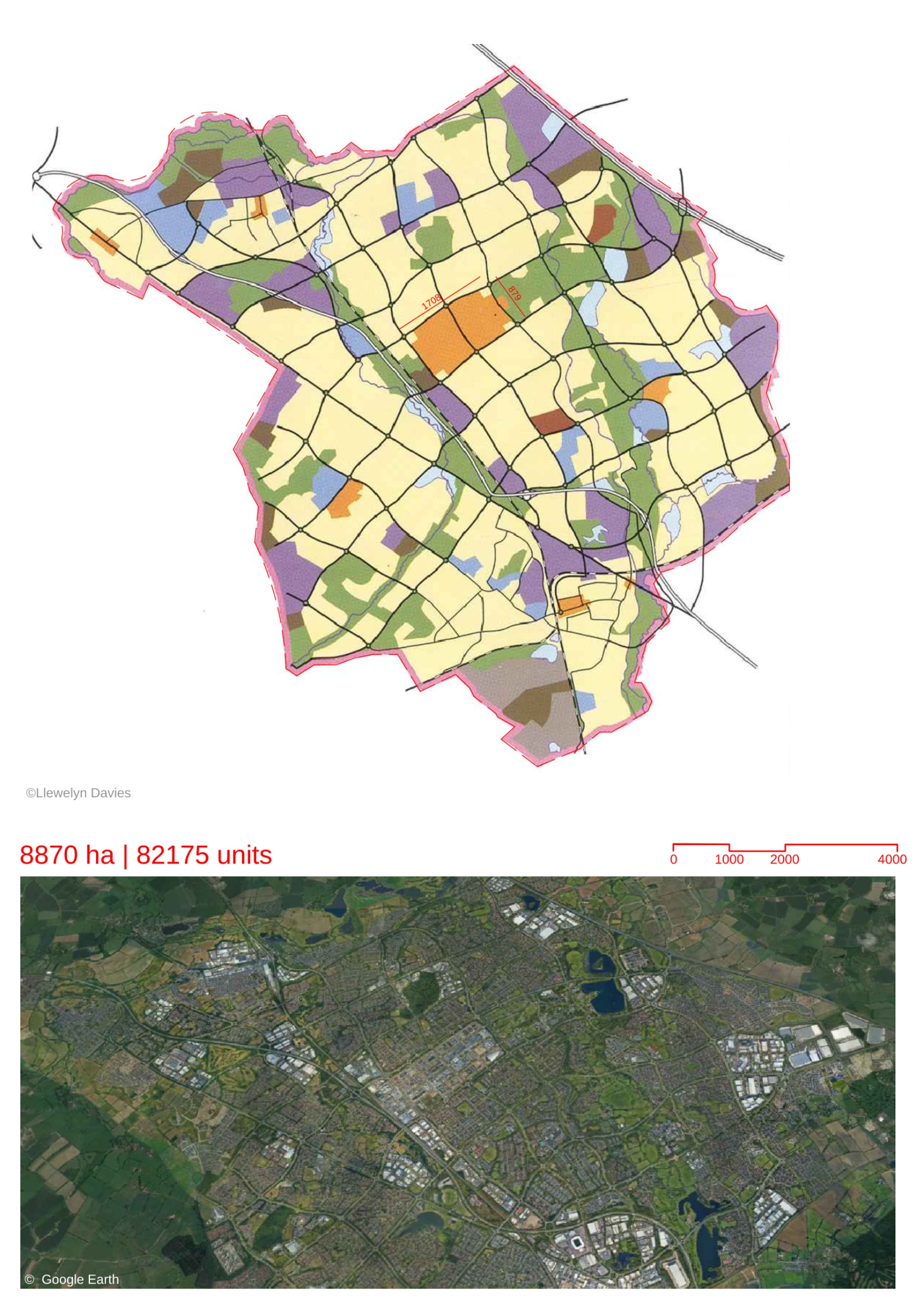
- It is a New Town located in the UK. It was built as part of the second generation New Towns initiative by the British government in the 1970’s.
- New Towns were greenfield developments meant to relieve urban congestion and housing shortages in the primary urban areas. They were conceptualized as satellite towns that could function as self-sufficient cities with encouragement towards local amenities and economic activities.
- The concept of New Towns is heavily influenced by the Garden City model proposed by Ebenezer Howard.
- Milton Keynes is divided into a characteristic grid of roads with roundabouts.As it was built during the modernist era, the plan was designed for easy mobility via car(a new upcoming mode of transport at the time) through the uniform grid.
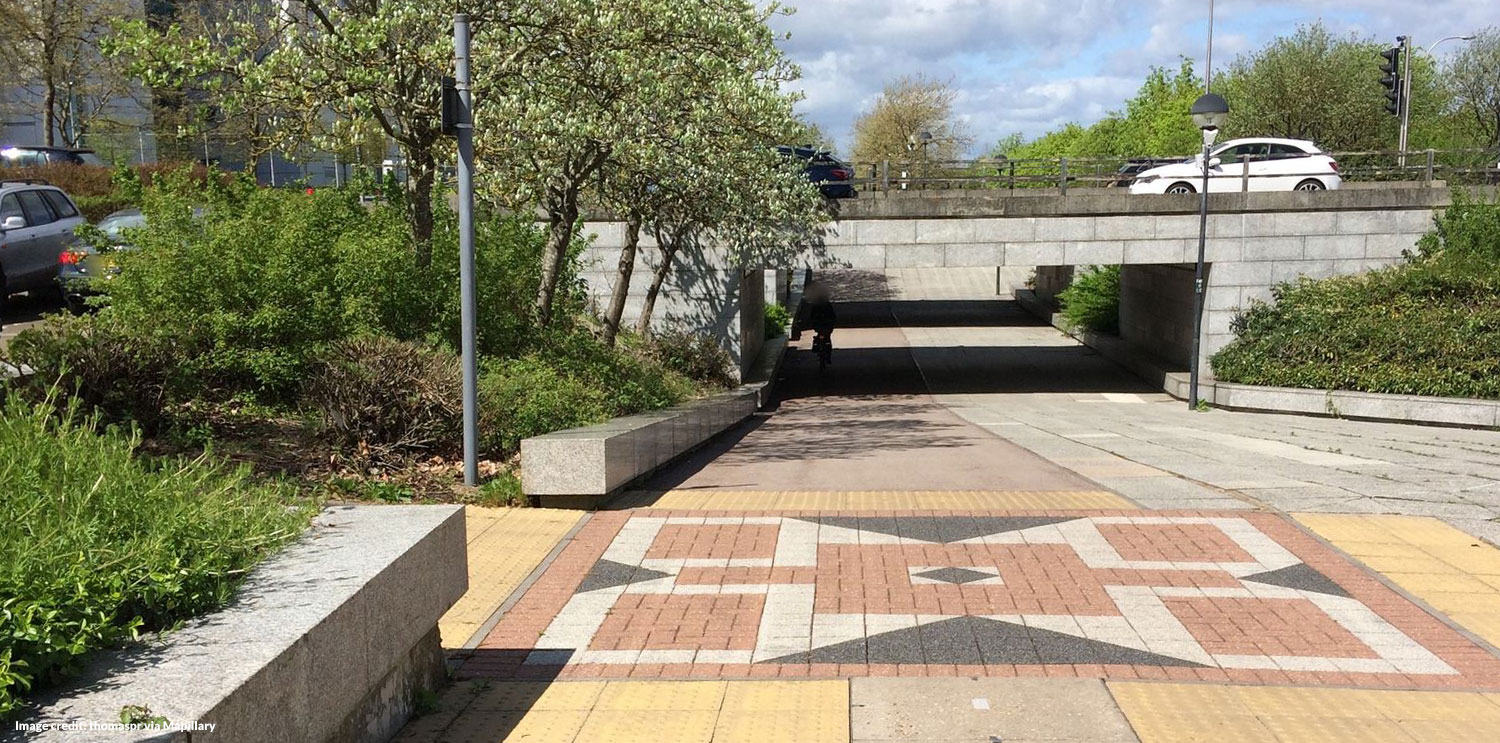
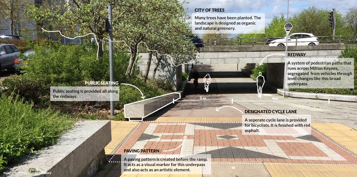
- A system of “Redways”, which are pedestrian and cyclist paths ,run throughout the entire plan.These pathways are segregated from vehicular circulation by level changes and broad underpasses.
- The masterplan was created by integrating existing settlements with new proposed villages. The existing identity and amenities of the region were enhanced through this strategy.
- A hierarchy of public centers is seen in the area. The Central district with the historic Town Centre (shopping mall) forms the primary hub for the entirety of Milton Keynes. The smallest scale in the hierarchy is composed of local centers referred to as “activity centres” that are located in each of the urban blocks formed by the grid.
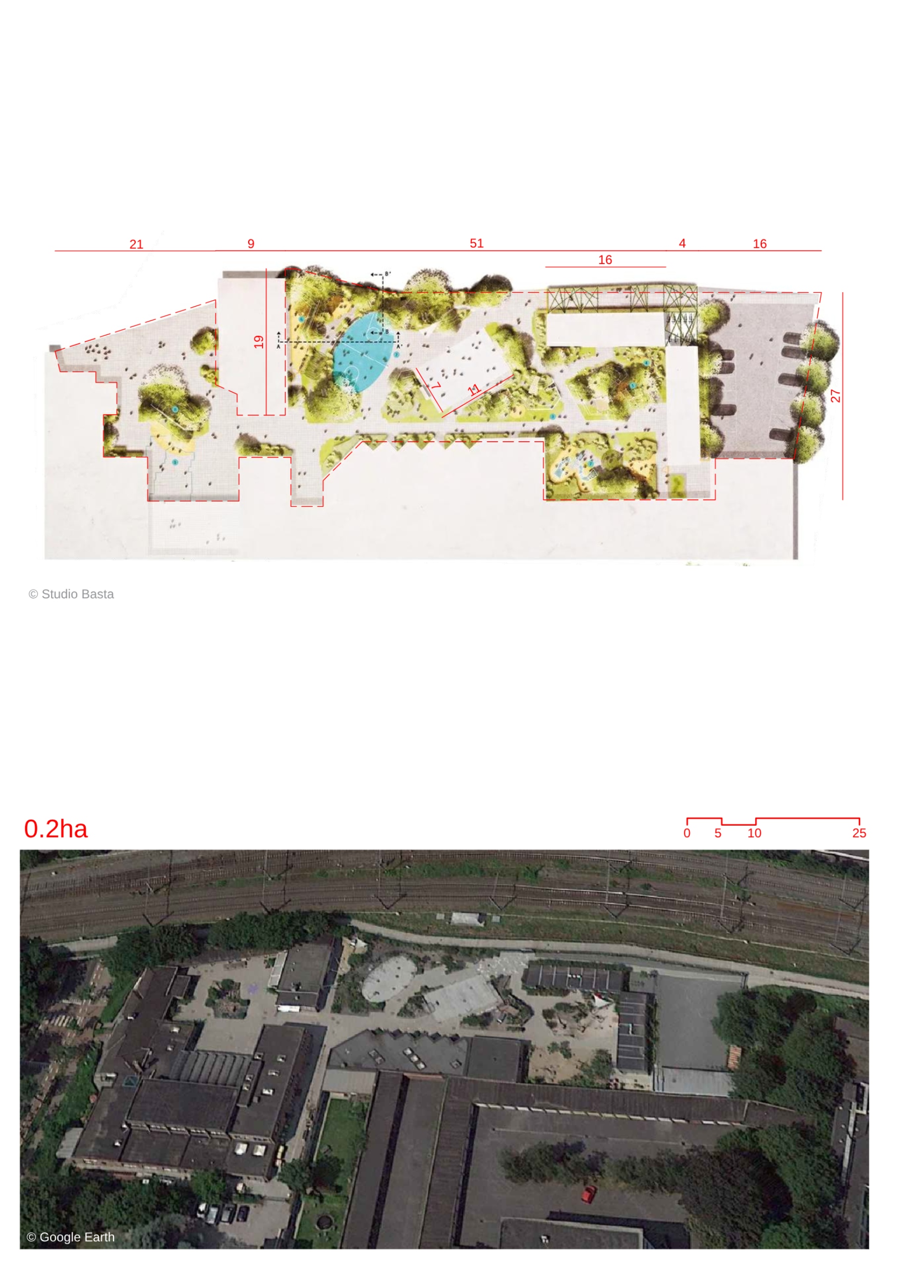
- Milton Keynes was conceptualized as a city of trees. Originally, 26 % of the area was reserved for open green spaces. It has urban parks as well as local open spaces to ensure that every resident has access to an open space within 800 meters of their home.
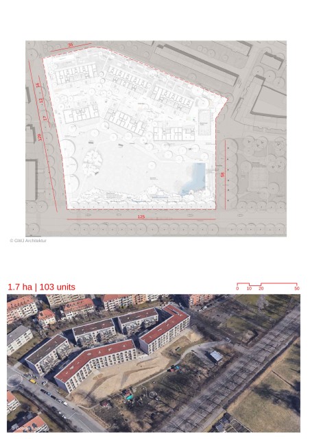
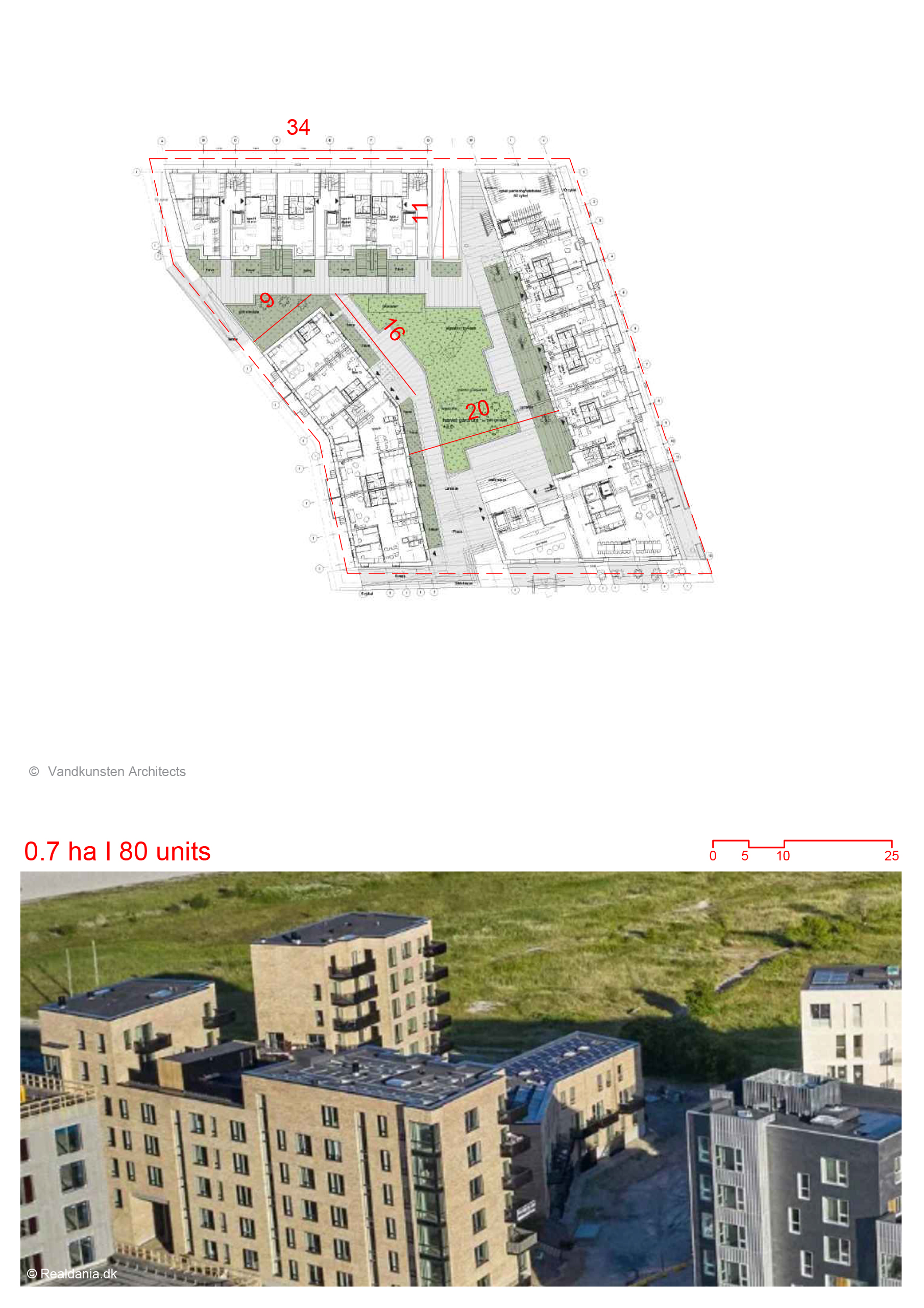
- A defining principle of the masterplan was to provide freedom of choice. The grid forms the framework of this principle. Each urban block created by the grid was meant to be an extroverted unit with constant connection with the surrounding blocks.
- These blocks were not provided with pre-defined plans for housing units. Flexibility and freedom was given to developers to create diverse housing schemes within each grid.
- The uniform grid meant to create a “non-place urban realm” as described by the planners. This would make the neighborhood universal and not divided by socio-economic classifications through its planning. Residents could choose where they wished to live. The uniform urban blocks with varying housing schemes were meant to encourage social mixing and integration of the residents.
- The landscape for the town is based on the ‘setting,string and beads‘ concept. The landscape design follows a more organic natural character in contrast to the uniformity of the town grid. The landscape design was by Peter Youngman.
- The town has a network of linear parks and waterways. They act as recreational green areas while also acting as rainwater buffers to prevent flooding. They form the “strings” of landscape.
- ”Settings” refers to larger green spaces that incorporate historic villages of the region. Beads are public spaces which form areas of outdoor activity and recreation for the residents.
Location map
Streetscapes
Explore the streetscapes related to this project.
|
Explore more Masterplans