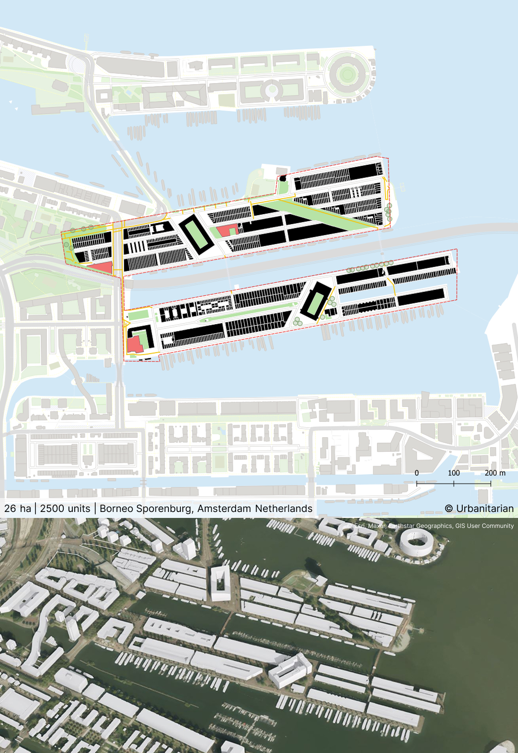
Borneo Sporenburg
By
WEST8
In
Amsterdam,
The netherlands
No collection found
Are you sure?
This will unsave the project your collection.
Compare
Compare this project with others
Details
Views:
5858
Tags
Data Info
Author
WEST8
City
Amsterdam
Country
The netherlands
Year
2000
Program
Residential development
Technical Info
Site area
260000 sqm
Gfa
0
sqm
Density
0 far
Population density
5350
inh/ha
Home Units:
2500
Jobs
0
Streetsroad:
0
%
Buildup:
0
%
NonBuild-up:
0 %
Residential
0 %
Business
0
%
Commercial
0
%
Civic
0
%
Description
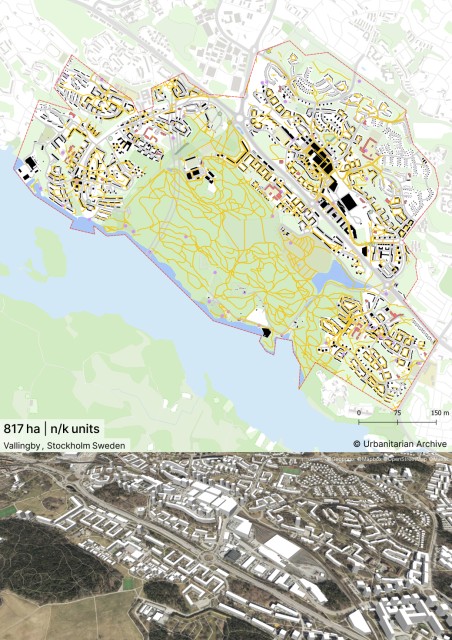
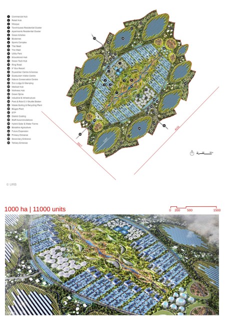
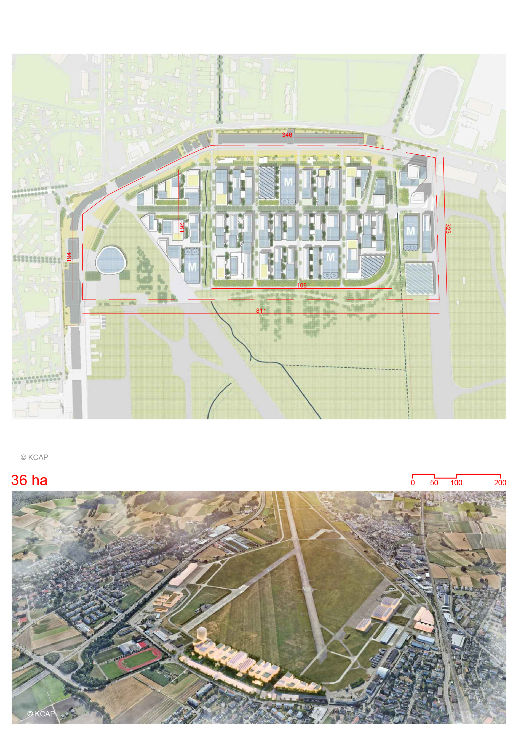
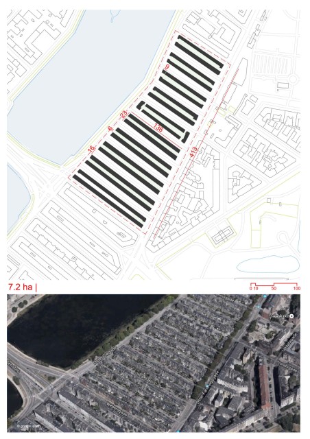
- Average density: 100 dwellings per hectare (the 600 dwellings in the three large housing blocks bring up the average density)
- Number of dwellings: 2,500 for Borneo Sporenburg / 17,000 for the Eastern Docklands
- The master plan of the district was designed by West 8 as a predominantly low rise neighborhood with a high density of 100 dwellings per hectare.
- The streets have been devised in a rectilinear layout with rows of houses.
- The single-family home forms the module of this masterplan. Each home is three-storied in a narrow plot. Each house consists of 30-50% of void space.
- There is no surface or street parking anywhere in the region. Individual parking has been provided within the narrow plots by creating split levels- a sunken garage and raised ground floor.
- The streets have been kept at a minimum width which increases spaces for buildings.
Location map
Interactive Map
This project includes an interactive map generated from GIS data, so you can study the masterplan as switchable layers instead of a single static image. Use the layer panel and legend to toggle buildings, green areas, water, streets, paths, site boundary, and trees to isolate specific systems and understand how they connect. You can also measure and change the basemap (light/dark/OpenStreetMap) to improve readability while you analyze.
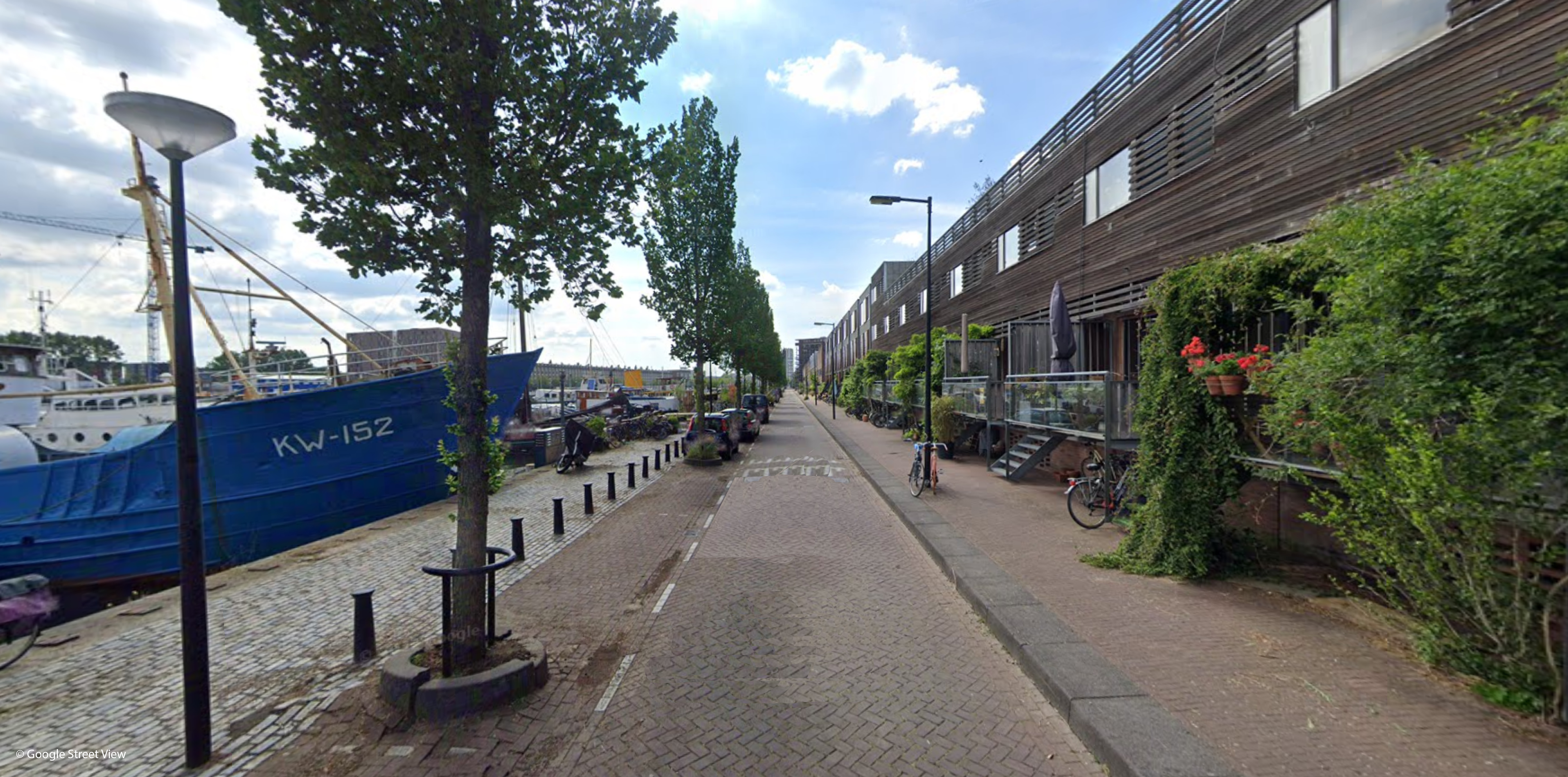
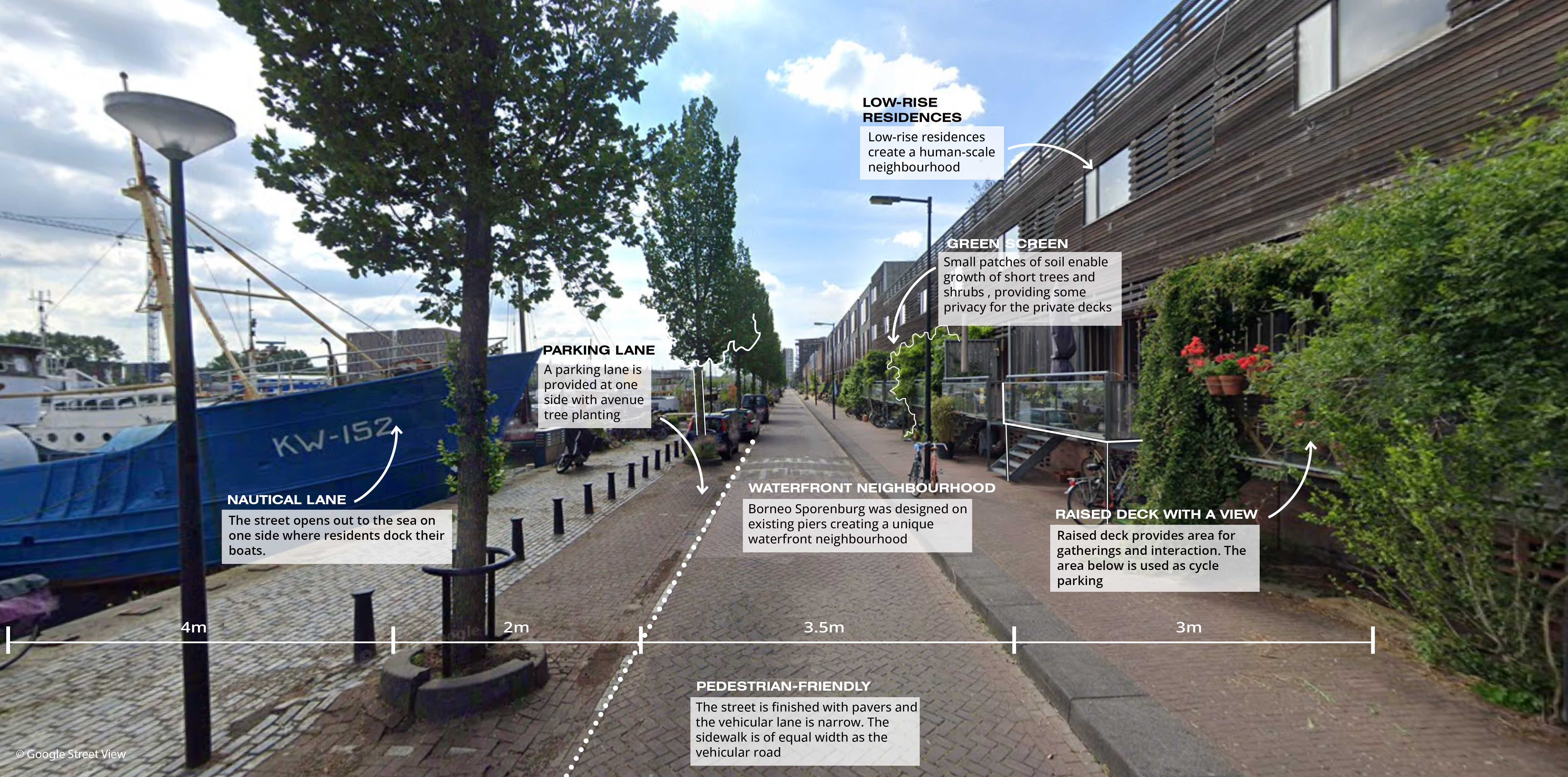
Streetscapes
Explore the streetscapes related to this project.
|
Explore more Masterplans