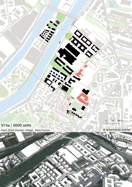
No collection found
Are you sure?
This will unsave the project your collection.
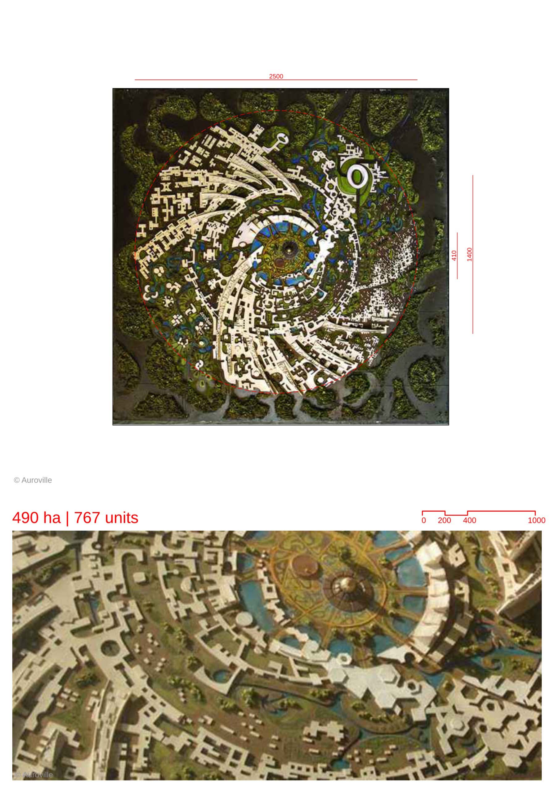
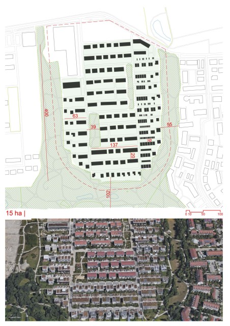
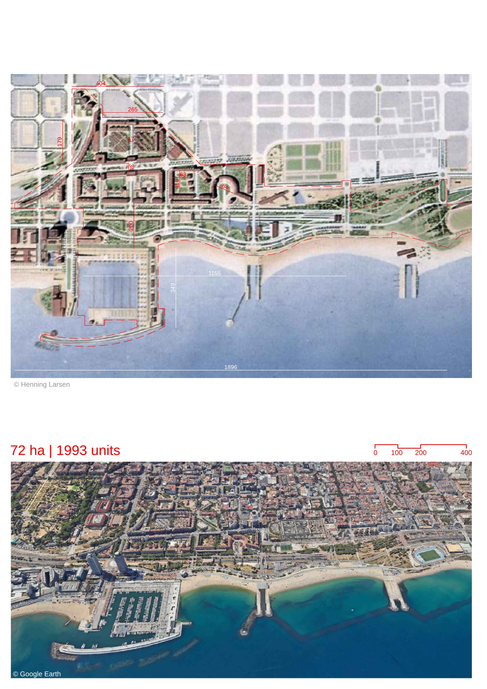
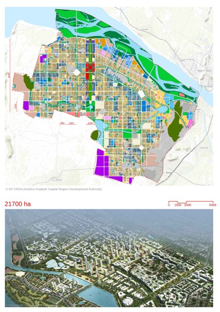
-Auroville has been designed as a universal township, centered around the concept of “human unity”. The universal township of Auroville is being developed based on the ideals of Sri Aurobindo and Mirra Alfassa (referred to as the Mother). -The masterplan, which is in the form of a “galaxy” with radiating zones, was conceptualized by French architect Roger Anger. The radial plan is divided into four key zones- Residential zone, Industrial zone, Cultural zone and International zone. At the center of the radial plan lies the peace area. -The Peace area houses the Matri Mandir (Temple of the Mother) and other landmarks which form the identity and focal point of the masterplan. -An area concentric to the peace area referred to as the “Crown Area” has been outlined as a special use zone with different land uses. This area would provide facilities to supplement the four key zones. It has a radius of 700m. -A green belt consisting of green spaces for agriculture, forestry and sanctuaries lies concentric to the city masterplan. -The masterplan conceives the city to be primarily a car-free city. --The distances of the concentric roads have been planned to achieve 5-7 minutes of walking distance between them. -The mobility of the Auroville is being developed as layers, starting as pedestrian friendly with slow traffic of 15 km/h (consisting of public transit) and eventually becoming completely vehicle-free, as one moves towards the center. -Twelve radial roads were proposed from the Crown Area.These would in some cases be lined with high-rise structures referred to as the “lines of force”. -The “lines of force” were conceptualized to bring about a sustainable method of managing the rising population of the city. They were planned to be areas of collective living, with a variety of unit types. They would have communal facilities such as dining rooms, libraries, laundry etc. They were meant to rise gradually in density and height from the center. -The masterplan aims to create an optimum mix of land uses creating a harmonious urban community,supplemented by a fertile green belt. This would create a model for a “rural-urban continuum” as stated in the Perspective Master Plan.