Ørestad Syd
By
TRANSFORM+BASCON
In
Copenhagen,
Denmark
No collection found
Are you sure?
This will unsave the project your collection.
Compare
Compare this project with others
Details
Views:
3389
Tags
Data Info
Author
TRANSFORM+BASCON
City
Copenhagen
Country
Denmark
Year
2014
Program
New mixed-use neighbourhood
Technical Info
Site area
300000 sqm
Gfa
0
sqm
Density
0 far
Population density
0
inh/ha
Home Units:
0
Jobs
0
Streetsroad:
0
%
Buildup:
0
%
NonBuild-up:
0 %
Residential
0 %
Business
0
%
Commercial
0
%
Civic
0
%
Description
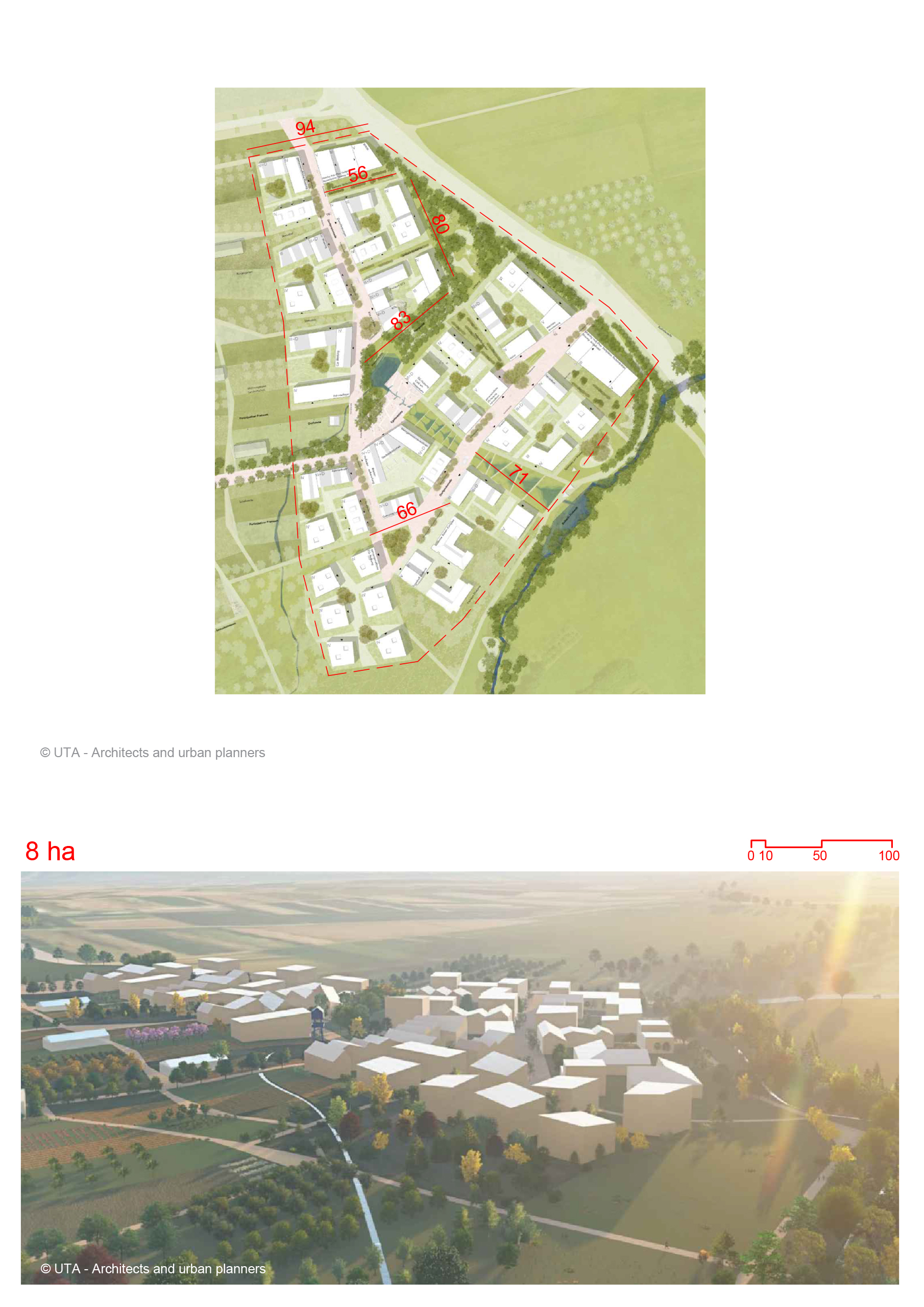
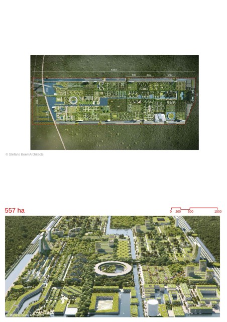
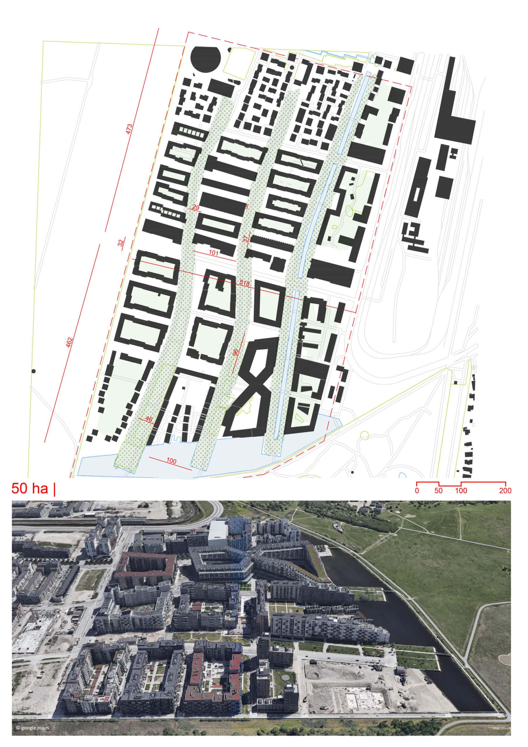
- On the edge of Copenhagen's largest natural area, Naturpark Amager.
- Close to national infrastructure, including Kastrup Airport, Ørestad Station, and the E20 highway.
- 13 minutes by metro to Nørreport Station.
- The urban plan focuses on creating a coherent residential city at all levels of scale, from large connections between city and nature to smaller social spaces like front gardens and steps.
- The design emphasizes density and green spaces.
- The boundary between urban areas and nature is dissolved, blending the built environment with the natural landscape of Naturpark Amager.
- The development is organized into distinct neighborhoods, with the main street serving as the central unifying urban space.
- Composed of distinct neighborhoods featuring terraced houses and housing estates.
- Towers and residential blocks are designed to minimize their footprint, leaving more space for open areas between the slopes and trees.
- The main street serves as the central urban space, unifying different areas of the neighborhood.
- Sustainability is a core aspect of the Ørestad Syd design. Water management plays a crucial role, with canals and ponds integrated into the stormwater runoff system .
- Use of energy-efficient buildings and green roofs .
- The landscape design includes soft, wavy hills and birch groves, especially in the Byliv i Birkelunden area.
- Water elements, including ponds and canals, a connect different areas of the neighborhood.
- The landscape also shelters citizens from wind and includes an "urban sports circuit"
Location and Connectivity
Urban Design Vision
Neighborhood Structure
Sustainability
Landscape
Location map
Explore more Masterplans