Strandlodsvej
By
HOLSCHER NORDBERG
In
Copenhagen,
Denmark
No collection found
Are you sure?
This will unsave the project your collection.
Compare
Compare this project with others
Details
Views:
876
Tags
Data Info
Author
HOLSCHER NORDBERG
City
Copenhagen
Country
Denmark
Year
2023
Program
Residential development
Technical Info
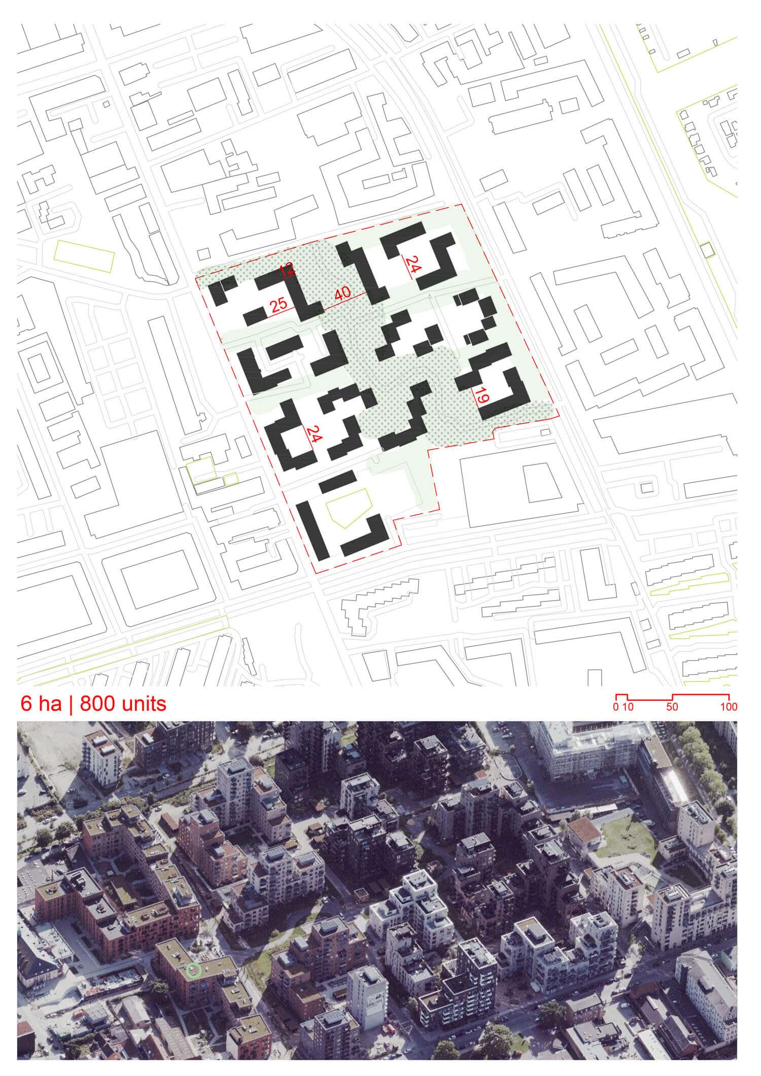
Site area
60000 sqm
Gfa
105000
sqm
Density
2 far
Population density
1700
inh/ha
Home Units:
800
Jobs
0
Streetsroad:
0
%
Buildup:
0
%
NonBuild-up:
0 %
Residential
0 %
Business
0
%
Commercial
0
%
Civic
0
%
Description
- The master plan for the development was drawn up in collaboration with the municipality through a series of workshops.
- Strandlodsvej is designated as an urban road in the municipal plan, ensuring efficient traffic management while minimizing through traffic and prioritizing bus and bicycle traffic alongside cars.
- The area is located 300-800 meters from metro stations Lergravsparken and Øresund, making it well-connected to public transport.
- The plan expects an increase in traffic by approximately 2,000 cars, bringing the total daily traffic to 5,500 cars on Strandlodsvej.
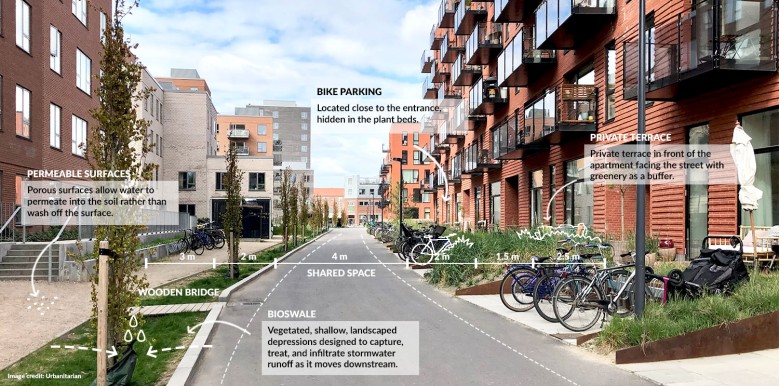
- New cycle paths will be created to promote cycling, offering alternative transport modes to reduce car reliance.
- Lergravsvej serves as a green link connecting Østrigsgade and Amager Strandvej, enhancing accessibility while integrating green spaces.
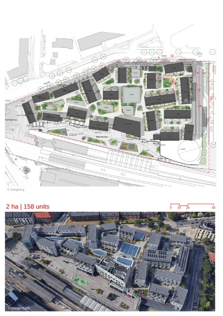
- The design is inspired by the neighbourhood’s diversity of large and small buildings and urban spaces, creating an architectural mix.
- The parcels are defined to create a sense of belonging for residents, with courtyards containing entrances, bicycle parking, drying racks, waste management, and nearby garden/play areas.
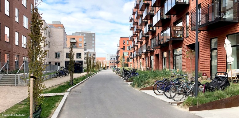
- Private terraces are built along the facades with access to open spaces, while the facades themselves feature clear entrance areas linked to individual apartments.
- The buildings range from two to twelve storeys with large terraced jumps, giving variety to the skyline.
- Three twelve-storey buildings are located along the disused Amager railway line, while an eleven-storey building marks a key corner of the site.
- Each building unit has its own architectural identity, maintaining diversity while contributing to the overall urban composition.
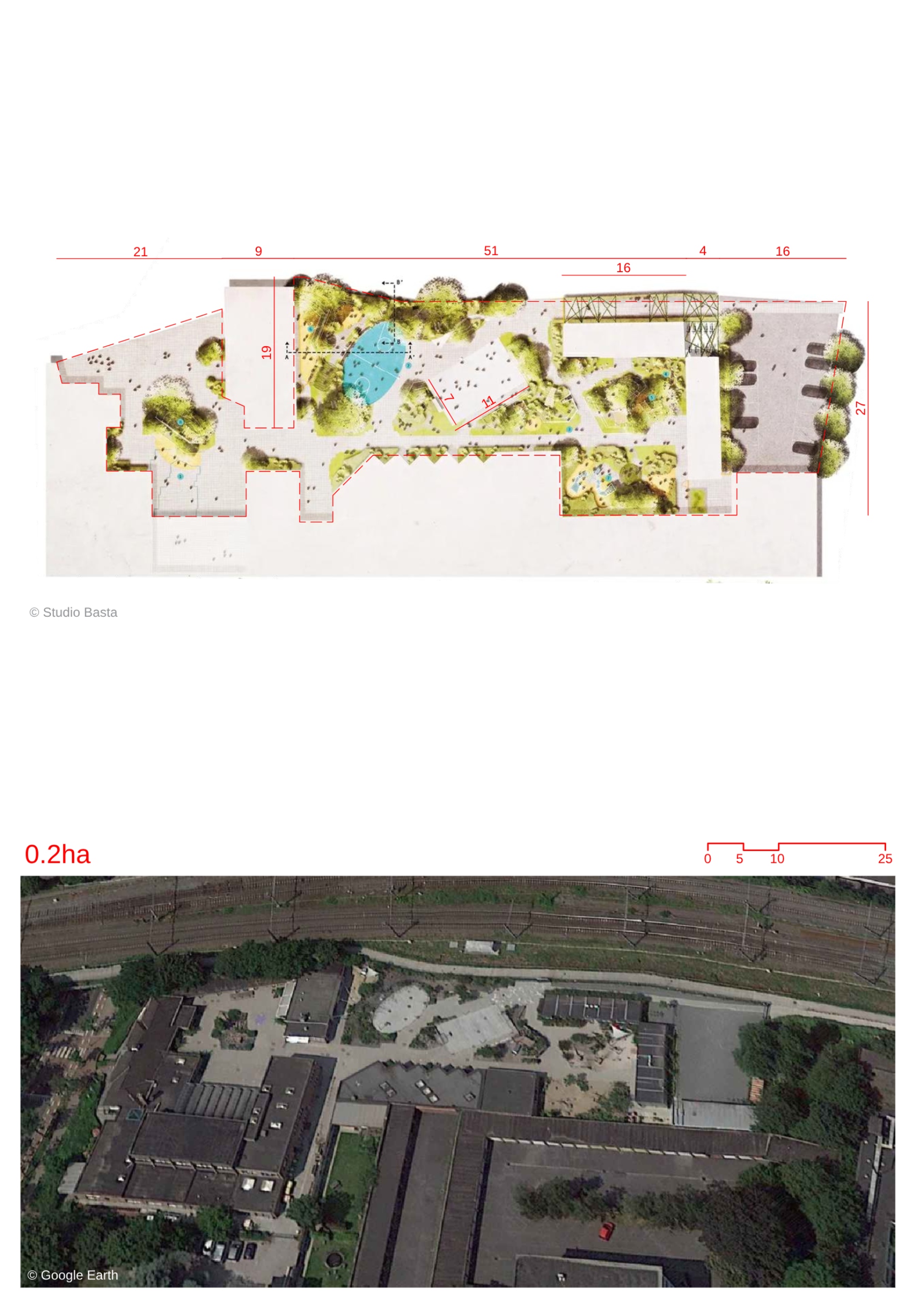
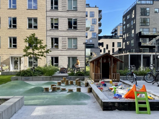
- The plan includes recreational and activity facilities for both residents and the neighbourhood, with shared roof terraces designed to encourage interaction.
- Publicly accessible paths wind diagonally through the site, connecting the city to the waterfront, and feature materials that allow for roller skating along the promenade.
- The courtyards offer defined areas for recreation, play, and rest depending on the surrounding context, creating a multi-functional landscape.
- In addition to the apartments, there is a 192-square-meter community room on the ground floor, available for residents to rent for gatherings and parties, serving as a daily communal space.
- The landscape plan includes open public grass areas interspersed with buildings, roads, paths, trees, and shrubs arranged in a deliberate composition.
- The shared roof terraces and green areas promote sustainability and encourage community interaction.
Urban Design and Masterplan
Traffic and Accessibility
Housing and Residential Design, Architectural Layout
Recreational and Community Spaces
Sustainability and Landscape
Location map
Streetscapes
Explore the streetscapes related to this project.
|
Urbanscapes
Explore the urbanscapes related to this project
|
Resources
Explore more Masterplans