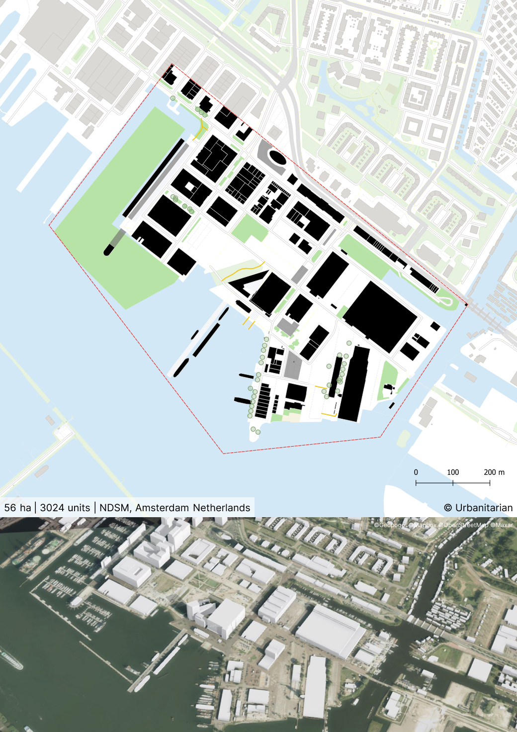
Nederlandsche Dok en Scheepsbouw Maatschappij (NDSM)
By
DE ARCHITEKTEN CIE
In
Amsterdam,
The Netherlands
No collection found
Are you sure?
This will unsave the project your collection.
Compare
Compare this project with others
Details
Views:
551
Tags
Data Info
Author
DE ARCHITEKTEN CIE
City
Amsterdam
Country
The Netherlands
Year
2008
Program
Waterfront development
Technical Info
Site area
567167 sqm
Gfa
677000
sqm
Density
1 far
Population density
0
inh/ha
Home Units:
3024
Jobs
0
Streetsroad:
0
%
Buildup:
0
%
NonBuild-up:
0 %
Residential
0 %
Business
0
%
Commercial
0
%
Civic
0
%
Description
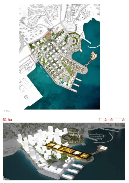
- It is a creative mixed-use district.
- The site was formerly a shipyard. After decline of business, the district gradually became a hub for the creative industry and companies like MTV.
- The transformation would result in nine core areas connected by streets, visual connections and promenades.
- The Eastern part would retain its industrial character. It consists of large blocks and open spaces. It would be pedestrian friendly.
- The Western part consists of an orthogonal grid of classic streets of 18m width. There would be clear segregation of public-private segregation.
- These urban streets would have trees planted on the sunny side and parking on the shaded side of the road.
- The main access road would be 30m wide and would be designed as a wide tree-lined promenade.
- The newer buildings would have simple geometric volumes with cantilevers and balconies. This would emulate the experience of being in a shipyard with various ship forms amidst the smaller harbour buildings.
- Slender high-rise buildings would act as accents with 45-60m height. The majority of the buildings would be at a maximum height of 30m.
- Many of the buildings areas would have temporary structures made from prefab or IFD (Industrial, flexible, demountable structures) with leases of 10 years to encourage densification.
- The transformation of the wharf aims to enhance the eastern part (with creative industries) while developing the unused west part into a high-density urban area with mixed-uses like housing, retail and education.
- The retail in the site would be restricted to thematic stores based on a nautical theme.
- New housing would be introduced. 30 % would be social housing.
- The harbourfront would be developed as a lively waterfront area with areas for leisure, culture and events.
- The existing eastern part would also host larger events like concerts. The Wharf Square would be designed for large events.
- The plinths would be designed to create active ground floor areas.
Urban Structure
Land Use
Creation of public spaces
Location map
Explore more Masterplans