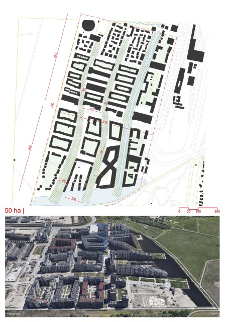
Funen
By
DE ARCHITEKTENCIE
In
Amsterdam,
The Netherlands
No collection found
Are you sure?
This will unsave the project your collection.
Compare
Compare this project with others
Details
Views:
1412
Tags
Data Info
Author
DE ARCHITEKTENCIE
City
Amsterdam
Country
The Netherlands
Year
2005
Program
Residential development
Technical Info
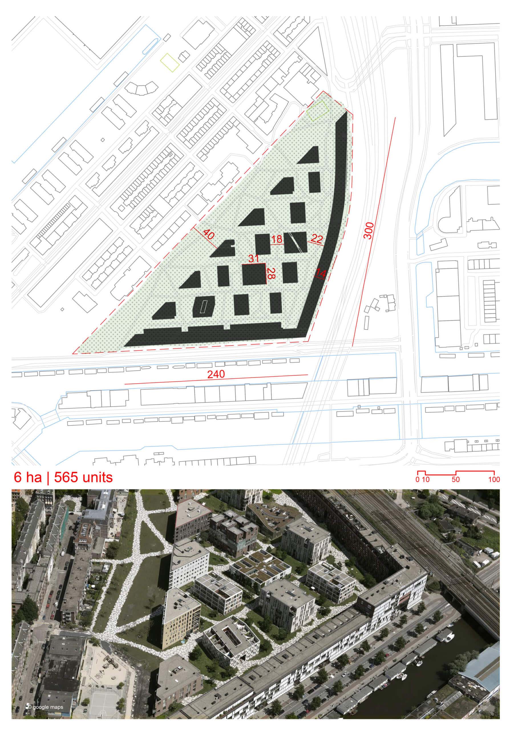
Site area
60000 sqm
Gfa
0
sqm
Density
0 far
Population density
1200
inh/ha
Home Units:
565
Jobs
0
Streetsroad:
0
%
Buildup:
0
%
NonBuild-up:
0 %
Residential
0 %
Business
0
%
Commercial
0
%
Civic
0
%
Description
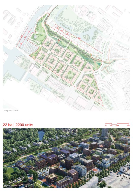
- The triangular site is bordered by:
- Existing neighborhood on one side.
- Nieuwevaart canal along the south side.
- Curving elevated railroad tracks on the east side.
- The design combines principles from perimeter block and garden city typologies.
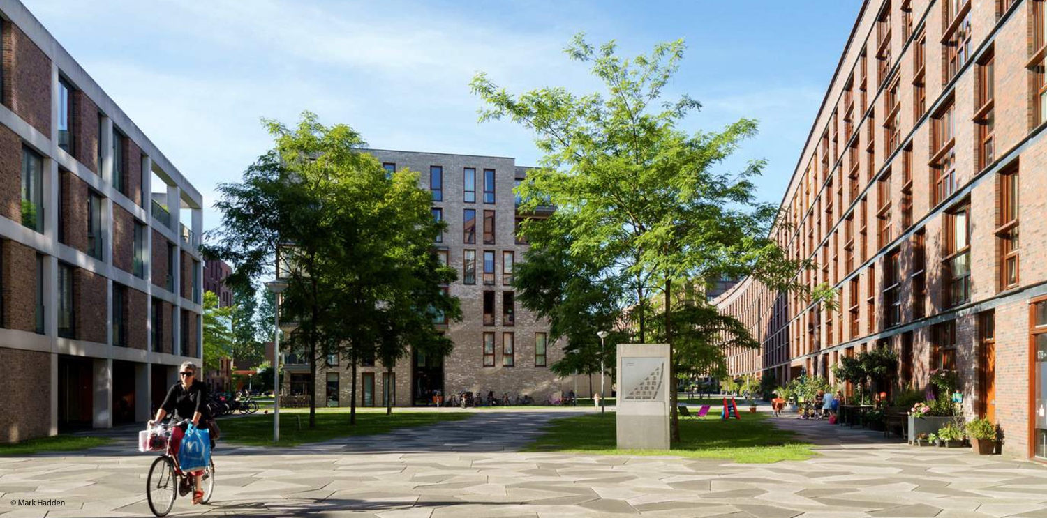
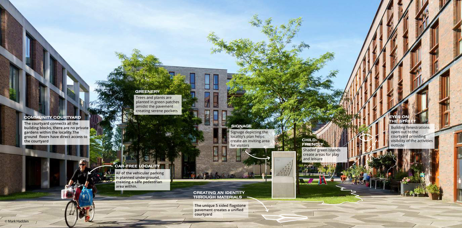
- The south and east sides are lined with “ell”-shaped brick slabs, enclosing an interior park area.
- A discontinuous grid of 16 free-standing urban villas is aligned with Cruquiustraat.
- Cars are parked in the basement of the perimeter slab, leaving the landscaped interior entirely for pedestrians.
- A wider swath of park is left between the existing buildings on the west side and the edge of the urban villas.
- The site is expressed as four distinct components:
- Funenpark: A shared public open space along the west side.
- Het Funen: The zone of urban villas.
- Sporenboog: The slab curving along the east edge.
- Cruquiustkade: The slab facing the canal along the south side.
- De Architekten Cie designed the two perimeter slabs, while 9 other architects designed the urban villas.
- The villas follow a fixed grid, but vary in design, materials, and height, ranging from 10 to 24 dwellings each.
- The design references a rational order but follows the model of free-standing elements in a garden setting.
- All villas are entered from the public garden space, with ground-floor dwellings enabled by the strategy of parking cars under the perimeter block.
- A continuous landscape mat between the buildings features a zig-zag pattern of paved walkways that define odd-shaped planters and lawns.
- The roofs are terraced, with 50% of the roof space used, creating sculptural objects in the landscape when viewed from upper levels.
Site Context
Master Planning Concept
Building Components
Architecture and Design
Landscape and Pedestrian Space
Location map
Interactive Map
This project includes an interactive map generated from GIS data, so you can study the masterplan as switchable layers instead of a single static image. Use the layer panel and legend to toggle buildings, green areas, water, streets, paths, site boundary, and trees to isolate specific systems and understand how they connect. You can also measure and change the basemap (light/dark/OpenStreetMap) to improve readability while you analyze:
Streetscapes
Explore the streetscapes related to this project.
|
Explore more Masterplans