No collection found
Are you sure?
This will unsave the project your collection.
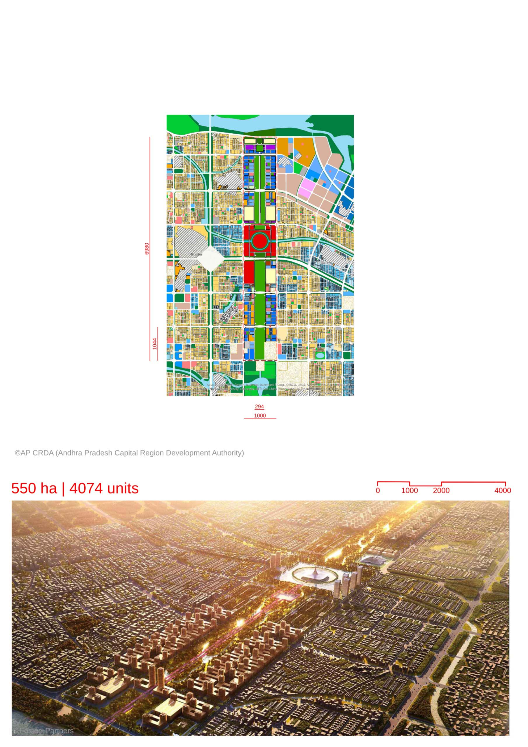
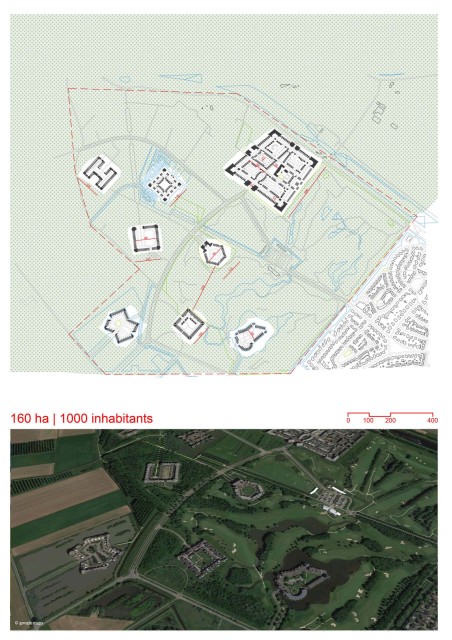
-The masterplan of the government complex at the proposed capital city of Amaravati , has been designed by Foster+Partners. -The complex follows an evident urban grid pattern with a central green spine,akin to the urban planning of global cities such as New York City and New Delhi. -The mixed-use masterplan balances a variety of programmes such as civic buildings, government housing , recreational areas, schools etc in order to create a diverse use of the land. -Ecology and the environment form a central theme in this design. Greenery and water compose 60% of the complex’s area, supplemented by the adjacent River Krishna. -Technologies such as photovoltaic rooftops have been proposed to generate energy and to bring about sustainability. -The transportation network has been designed to be future-ready, in-line with the rapid growth of technologies in India such as electric vehicles. -The network of walkable streets and well-defined cycle routes blend seamlessly into the macro scale transportation strategy. They further supplement the connectivity of the various planned public spaces such as the riverfront promenade and plazas. -The centrally located legislative assembly building has been designed to be a visual marker of democracy as well as an identity for a modern yet culturally grounded Amaravati. Its features such as the form,orientation and surrounding walkways follow principles of Vaastu, a science of ancient Indian architecture. -The project has been dubbed the People’s Capital. The mixed-use masterplan weaves together civic buildings and private mixed-use with public spaces such as plazas and vistas. This would enable interactions between the public and the government.