Veghels Buiten
By
BUREAU B+B,ATELIER LOOS VAN VLIET
In
Veghel,
The Netherlands
No collection found
Are you sure?
This will unsave the project your collection.
Compare
Compare this project with others
Details
Views:
454
Tags
Data Info
Author
BUREAU B+B,ATELIER LOOS VAN VLIET
City
Veghel
Country
The Netherlands
Year
2012
Program
Residential Neighbourhood
Technical Info
Site area
3750000 sqm
Gfa
0
sqm
Density
0 far
Population density
2000
inh/ha
Home Units:
0
Jobs
0
Streetsroad:
0
%
Buildup:
0
%
NonBuild-up:
0 %
Residential
0 %
Business
0
%
Commercial
0
%
Civic
0
%
Description
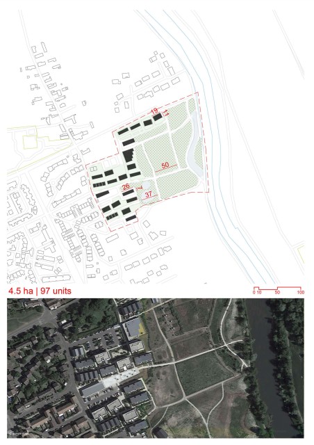
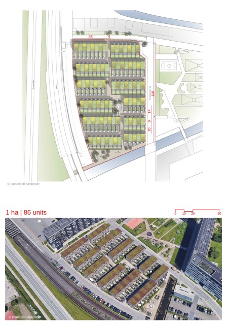
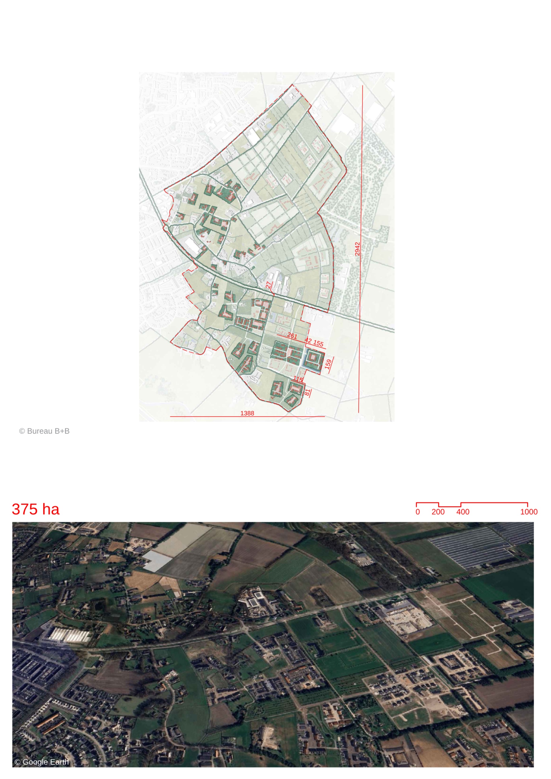
- The residential neighbourhood is designed for organic growth and slow development, integrating new residential typologies into an existing vernacular countryside settlement.
- The plan ensures that clusters of 30-250 homes are connected by a network of roads, avenues, and paths, allowing for gradual growth and flexibility in development.
- The design prioritizes the maintenance of the agrarian landscape, with various cluster densities to accommodate new development while allowing existing pastoral land to remain cultivated.
- Newly reclaimed land will feature more adaptable housing typologies, whereas older, existing tracts will have minimal development, retaining the rural character of the area.
- Three main residential typologies are introduced:
- Farmyard typology: Small clusters of 2-8 homes around shared yards.
- Courtyard typology: Homes arranged around a central courtyard with winding streets.
- Monastery-type: Large enclaves of up to 150 homes with a shared garden, reminiscent of local monastery layouts.
- The plan retains significant poplar vegetation and uses rows of trees to demarcate clusters, preserving the natural landscape and defining residential areas.
- A rainwater management system incorporating bioswales and existing ditches will handle stormwater onsite, supporting environmental sustainability.
- Recreational spaces are integrated into the greenery, with parks and a fitness trail open to the public.
- Located close to a town with access to public transport.
Urban Design and Growth Strategy
Preservation of Agrarian Landscape
Residential Typologies
Sustainability and Landscape Integration
Recreational Spaces
Accessibility and Connectivity
Location map
Explore more Masterplans