Brasilia
By
LUCIO COSTA
In
Brasilia,
Brazil
No collection found
Are you sure?
This will unsave the project your collection.
Compare
Compare this project with others
Details
Views:
4489
Tags
Data Info
Author
LUCIO COSTA
City
Brasilia
Country
Brazil
Year
1957
Program
Capital City
Technical Info
Site area
245000000 sqm
Gfa
0
sqm
Density
0 far
Population density
2000000
inh/ha
Home Units:
0
Jobs
0
Streetsroad:
0
%
Buildup:
0
%
NonBuild-up:
0 %
Residential
0 %
Business
0
%
Commercial
0
%
Civic
0
%
Description
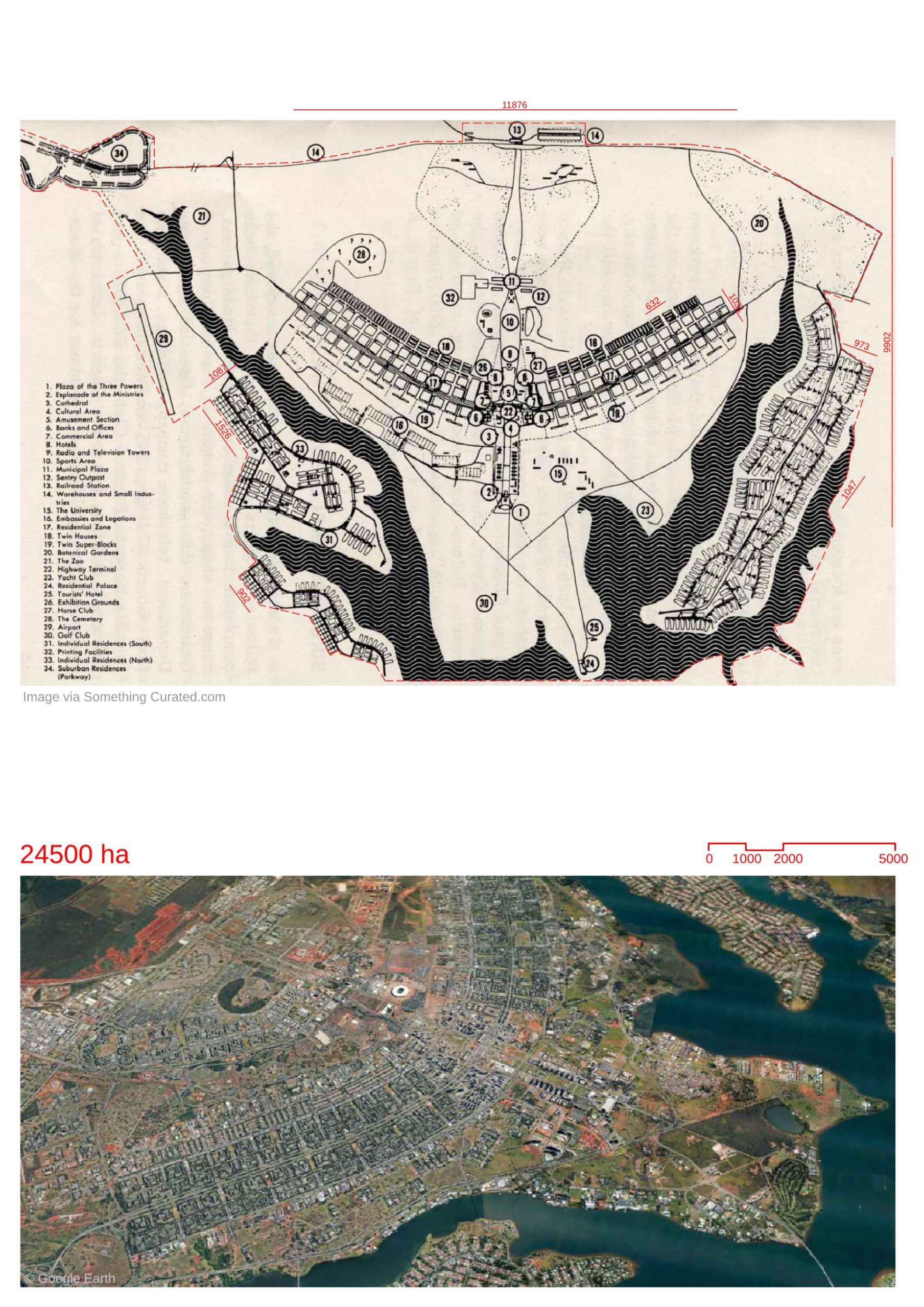
- -The plan of Brasilia the capital city of Brazil is in the form of a bird in flight. The plan was proposed in 1957 as Plano Piloto (Pilot Plan) by urban planner Lucio Costa.
- The masterplan has four primary scales- monumental, residential, social and bucolic.
- The monumental scale is seen in the central axis running in the East-West direction. It contains areas for the civic administration of the country.
- The monumental axis is complemented by presence of the unique monumental buildings designed by Oscar Niemeyer.
- Most famous is the Three Powers Square which contains the Presidential Palace , Supreme Court and Congress.
- The "winged" North-South axis runs along the topography of the area. It form the main transport thoroughfare axis.
- Along the thoroughfare , lie the residential units referred to as "superquadra".
- The "superquadra" are modular neighborhood blocks. These neighborhoods were designed to be a functional mix of residents and amenities.
- The social scale was defined at the intersection of the E-W and N-S axis. This area contained areas for business and retail and was to be the city center district.
- The bucolic scale was the network open green and public spaces that permeated the remaining three scales .
- The masterplan is highly influenced by Modernism. Hence it was designed for the use of vehicular transport which was seen as a an upcoming and futuristic mode of transport.
- This can be seen in the emphasis on the central thoroughfare and the streets were rounded without corners to allow smooth flow of traffic and to protect pedestrians.
Location map
Explore more Masterplans