DOWNSVIEW
By
HENNING LARSEN, KPMB,SLA, URBAN STRATEGIES INC.
In
Toronto,
Canada
No collection found
Are you sure?
This will unsave the project your collection.
Compare
Compare this project with others
Details
Views:
484
Tags
Data Info
Author
HENNING LARSEN, KPMB,SLA, URBAN STRATEGIES INC.
City
Toronto
Country
Canada
Year
2019
Program
Residential District
Technical Info
Site area
2100000 sqm
Gfa
0
sqm
Density
3 far
Population density
83500
inh/ha
Home Units:
46000
Jobs
41500
Streetsroad:
0
%
Buildup:
1
%
NonBuild-up:
0 %
Residential
0 %
Business
0
%
Commercial
0
%
Civic
0
%
Description
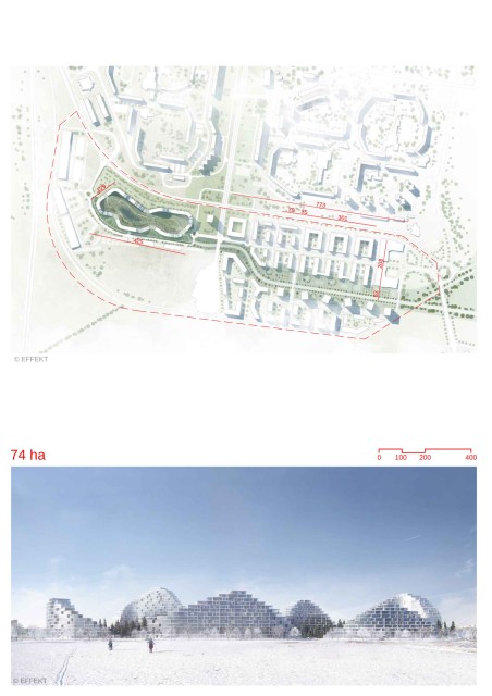
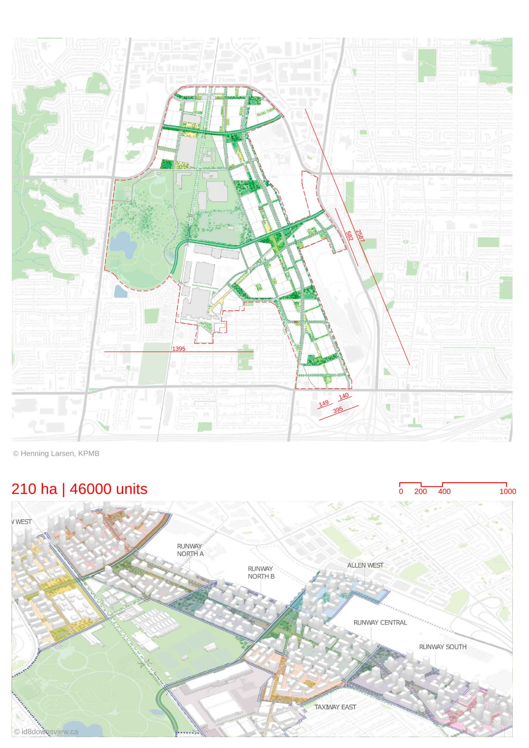
- -The Downsview is an urban redevelopment project of a former airport site. The area is being planned as a mixed-use residential district,
- The design is inspired by the 15 minute walk concept, where all necessary amenities such as parks, schools and shops are accessible to residents in a 15 minute walk.
- The plan also proposes a concept of “City Nature”, where there is an integration of green spaces within the urban environment. The green spaces of the plan account to a total of 100 acres.
- The plan pays homage to the old runway at site, by proposing a vibrant pedestrian corridor - “The Runway” at its location. This acts as a central spine for the 10 new proposed districts of Downsview. “The Runway” runs for a continuous stretch of 2.1 km. It is car-free and universally accessible,
- This pedestrian corridor connects the major public parks of the city. The green spaces have been arranged to be accessible by a 5 minute walk from the residences.
- The plan incorporates blue-green infrastructure. The open green spaces allow for stormwater integration, wildlife habitats and movement of residents, flora and fauna.
- There are 8 district parks at various parts of the area, ranging from 0.8-2.8 hectares in area. They would be located at a distance of 500m from each other.
- A network of greenways run across the area. They would act as mobility corridors and green spaces for pedestrians and cyclists.
- There is an interconnected mobility network where connections are established to transit stations by providing first and last mile connectivity. Features include complete streets, new multi-modal crossings, greenways and integrated cycling networks.
- The main streets are mixed-use and focus on hosting local commerce and dining. They are pedestrian-first and are activated at ground level.
- The street network also follows Complete Street principles, where there would be safe movement of multi-modal transport and pedestrians in the same street.
- The building forms throughout the site would be primarily mid-rise (6-14 storeys). High-rise structures would be located near transit locations.
- The mid-rise development would help generate comfortable densities for employment and housing opportunities and would support the local economy. There would also be an ambient microclimate.
Location map
Explore more Masterplans